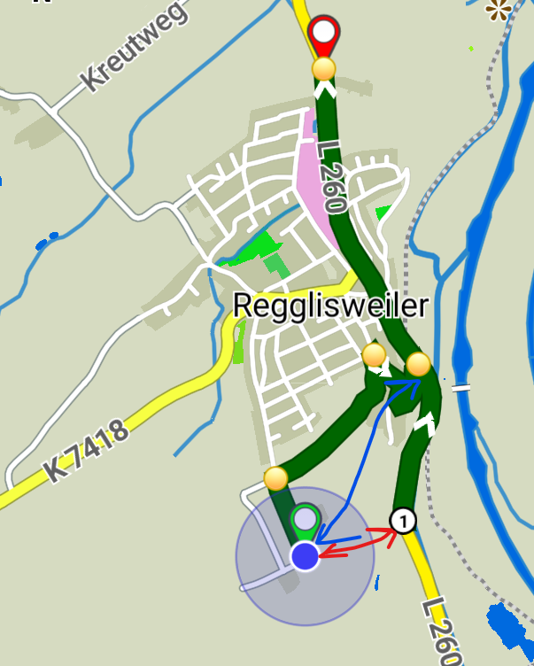
If the user would have manually set a WP at the (1) nobody would be surprised.
So the “issue” is that humans think that *nearest point on route" should be at the intersection (blue arrow). The driver can ignore the shaping point (1) and navigation should continue normally, so it is not a big deal.
I think (in theory) this could be solved with only a single route calculation.
- keep the original route in memory
- do a route calculation towards nearest point on route
- the point where the new route hits the original one, should be the correct place to merge the two routes.
Probably a lot of work for a simple problem.