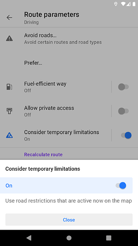
OsmAnd route parameters has a “Consider temporary limitations” on / off switch,
which gets passed to its routing engine.
Okay. Does it mean you also consider this for Kurviger? I am in favour.
It’s something interesting I noticed recently.
First the routing server has to support it and then I can add it to the application.
Got the same problem today.
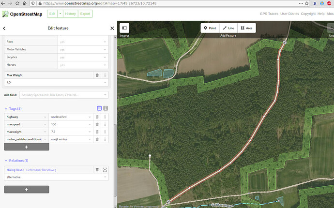
The street has a tag motor_vehicle:conditional set to “no @ winter”, combined with two lift gates.
Both lift gates were open today, but it was not possible to route the tour via this street. If that’s a
bug in OSM, I’m willing to fix it, but unfortunately I don’t see what the actual bug here is…
Corinna
Um die Arbeit aller zu erleichtern und Dir helfen zu können wäre es sehr hilfreich wenn Du die Route teilen könntest. Oder wenigstens das enstsprechende Teilstück, denn Geißberggraben zu finden ist gar nicht so einfach.
To make everyone’s work easier and to be able to help you, it would be very helpful if you could share the route. Or at least the corresponding section, because finding Geißberggraben is not that easy.
In dem Fall, https://kurv.gr/UypHW, ist es so das bei den Schranken zB access=yes fehlt, siehe dazu Die Routenberechnung verhält sich komisch bzw. fehlerhaft. Was kann ich tun? [Kurviger Knowledgebase] unter Barrieren.
In this case, the barriers are missing access=yes, see Die Routenberechnung verhält sich komisch bzw. fehlerhaft. Was kann ich tun? [Kurviger Knowledgebase] under barriers.
Sorry, I thought the URL in the picture is sufficient, but I should have sent it in text, too.
In terms of the barrier access, these barriers have the “Allowed Access” fields in there
the field “All” is set to yes, the rest of the fields are undefined. In theory, one should
think this information is already sufficient for routing purposes.
Anyway, I added the access=yes flag in OSM for both gates.
Thanks,
Corinna
That is a known issue of the OSM editor iD (which is the default on the OSM website). You can find the related issue here: Display barriers with appropriate access tags · Issue #4344 · openstreetmap/iD · GitHub

