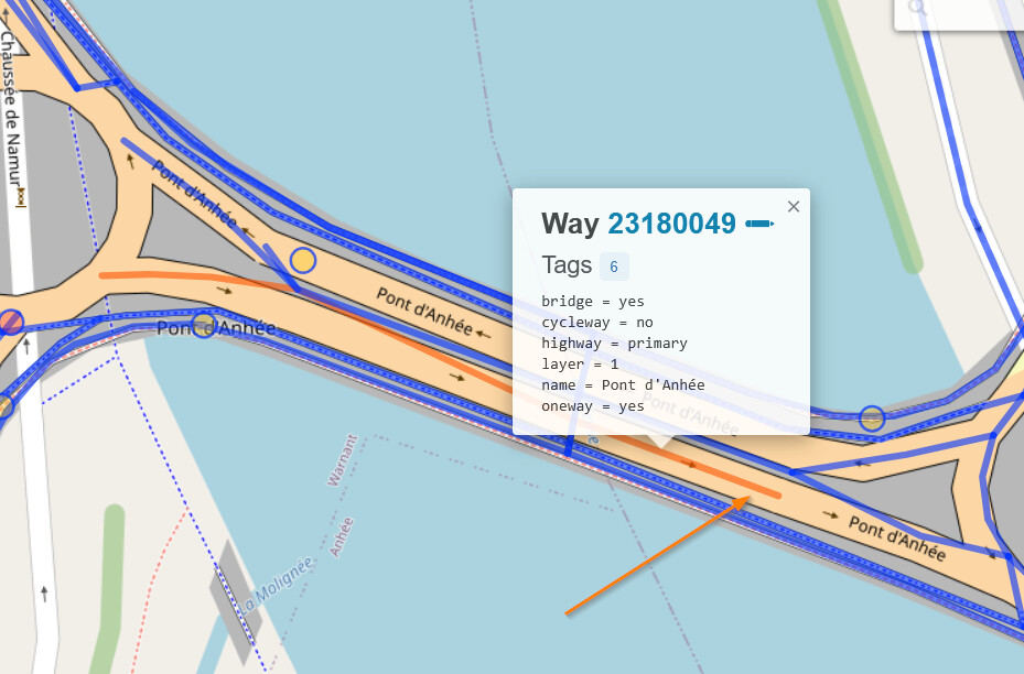
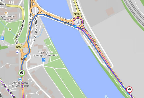
While importing a GPX I got a strange detour at some point. Somehow Kurviger thinks I should not cross the river using a weird combination of roundabouts, but should take the bridge seven km’s further.
I tried many ways to create a route between 50.315846, 4.8749900 and 50.313633, 4.8804080 but failed.
I read something about a reason the data in OSM may be incorrect, but I have no idea where to start to help to fix this.
Anyway, importing a GPX works very nice these days, it is getting better and better over time. Thanks for that.
The first phase is apparently expired, but I do not find the information when and how long the second phase will be. It says though, that the de iation will be organized by the company conducting the work.
So, maybe connect the points on your route with a beeline and follow the instructions on site. Most likely the will keep one half of the bridge open, rather then sending everyone on the 15km deviation.
It is a comlicated junction with all its roundabouts and a bridge, and I could not immediately find the issue in OMS, so I went for the good ol’ Google…
The whole area was heavily changed in the last days, about April 28th. Openstreetmap is routing, but the route is not on the street. Perhaps we wait some days until everythig is updated, also the maps and routing from openstreetmap.
Checking the changes of the last 5 days shows a “dead end”, but I can not see it in edit-mode. As Kurviger updates every 2 to 3 days, I guess the routing data from Kurviger is most up-to-date.