This topic has low prio - just comfort / readability.
Triggered by a user feedback I modified my pass download page described in
Change: If a mountain pass / saddle has an elevation tag, the elevation is also written to the <ele> tag of waypoint in GPX. Example:
mountain_passes (11).gpx (20,7 KB)
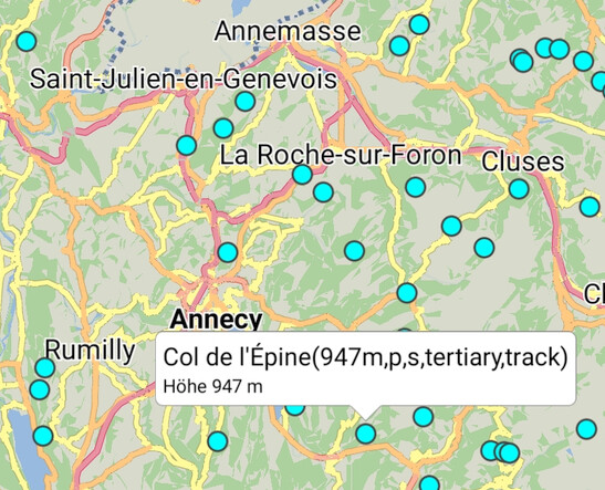
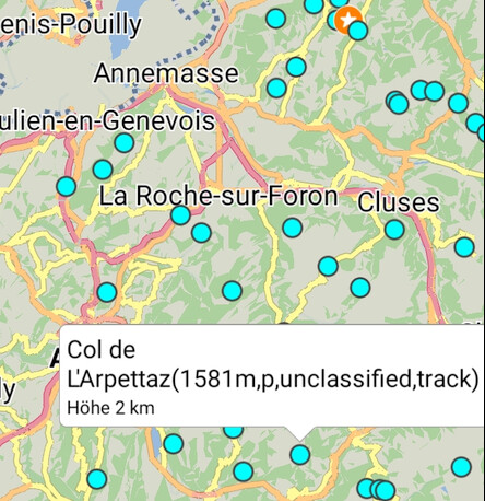
The <ele> tag is also used by the Kurviger app when importing GPX as overlay ![]() , but for passes with an elevation >= 1000m the elevation is shown with unit ‘km’ without any decimals. Passes with lower elevation are shown in m (german screenshots: “Höhe” = Height / Elevation):
, but for passes with an elevation >= 1000m the elevation is shown with unit ‘km’ without any decimals. Passes with lower elevation are shown in m (german screenshots: “Höhe” = Height / Elevation):
I think it would be useful to show the elevation always in m.
Remark: To be able to see the elevation also in programs / navigation devices ignoring the <ele> tag currently the elevation is also put in brackets at the end of the name - that’s the reason why you see it twice in the screenshots.