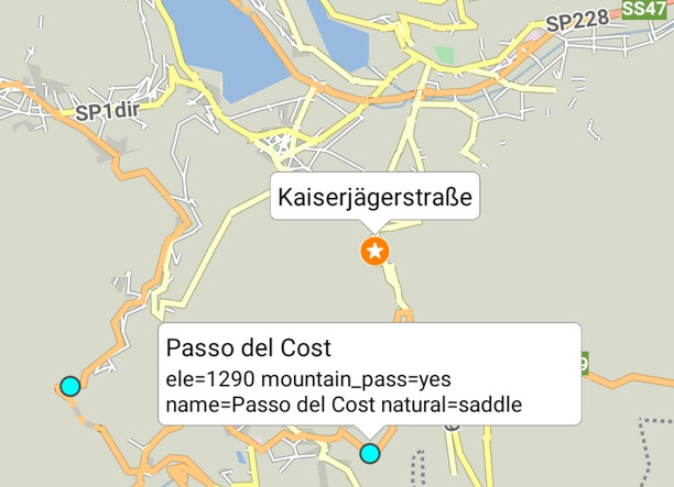
After importing GPX with waypoints (XML tag <wpt>) as overlay they are shown on map and can be also tapped to show information (same way as bookmarks):
My suggestion: Add the same context menu (long tap on them) to overlay waypoints as to bookmarks.
Reason: If you have a list of POIs as GPX, which you do not want to add to your bookmarks, it would be much more comfortable to add them to routes (including copying the name). Example in my case: A list of mountain passes exported from OSM via overpass-turbo - even for a small region of italy there are > 300 mountain passes, which I do not want to add to my favorites.
Another example would be using a passknacker export as described in documentation - there are so many passes that it is not useful to import them in favorites.
This topic has low prio - just comfort / readability.
Triggered by a user feedback I modified my pass download page described in
Change: If a mountain pass / saddle has an elevation tag, the elevation is also written to the <ele> tag of waypoint in GPX. Example: mountain_passes (11).gpx (20,7 KB)
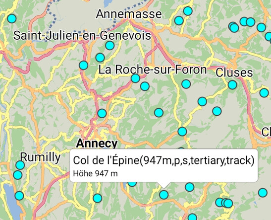
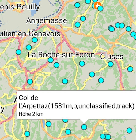
The <ele> tag is also used by the Kurviger app when importing GPX as overlay , but for passes with an elevation >= 1000m the elevation is shown with unit ‘km’ without any decimals. Passes with lower elevation are shown in m (german screenshots: “Höhe” = Height / Elevation):
I think it would be useful to show the elevation always in m.
Remark: To be able to see the elevation also in programs / navigation devices ignoring the <ele> tag currently the elevation is also put in brackets at the end of the name - that’s the reason why you see it twice in the screenshots.