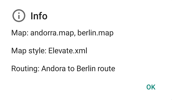
Provide an info screen for the loaded map(s), map style, route file, etc.
Could it include info about online or offline map?
If it displays *.map files, then the map is offlne.
If something else appears, then it is online map.
Do you mean an explicit [offline / online] tag?
(that could be done)
Yes, would perhaps prevent misunderstandings.
Deepl übersetzt:
I would also appreciate it if you had a quick overview of whether you have the online or offline map in front of you.Just an idea of mine:If you have a button zb.+ or - with a
depending on the open map changing color would save an info window or similar, and you would always have the overview of the currently open map.
I do not know if it would be feasible at all, just an idea.
Greeting manfred
Deutsch
Ich würde es auch begrüßen,wenn man eine schnelle Übersicht hätte ob man die online oder die offline Karte vor sich hat.Nur eine Idee von mir:Wenn man eine Schaltfläche zb.+ oder - mit einer je nach geöffneter Karte wechselnder Farbe hinterlegt würde man sich ein Infofenster oder ähnliches ersparen,und man hätte stets den Überblick über die momentan geöffnete Karte.Ich weiß nicht ob es überhaupt realisierbar wäre,eben nur eine Idee.
Gruß manfred
Provided again in Kurviger 1.14.28.
Available in menu “Tools | Info”.
If I just plan a new route in Kurviger Pro without saving it (-> no name given yet) and use the info function, only the loaded offline maps are shown.
If I pan the map (route is shifted of the map), close the app and open the app again, the route is still available but neither shown on map nor by using info function.
(Real use case: Start map planning in hotel in the evening, leave tablet switched on in hotel room during dinner, tablet shuts down due to empty battery).
Therefore I propose to show the default name (timestamp) of the route in info field if no name given yet.
Priority of proposal is low - I think that use case does not happen so often.
You can find the route on the map using the menu “Routing | Actions | Show whole route”.
Hi
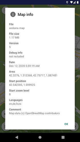
This is very useful. Do the offline maps also have some date/time info available? I.e., when they were created originally? If so, can we show this in the info dialog as well?
Thanks,
Tom
There is a lot of (technical) information available (image is from Cruiser):
The date will be available in the next update of the application.
Thanks. Very nice.
Cheers,
Tom
This not realized in Kurviger 2 - right?
(I still notice that always after restarting the smartphone Kurviger works with an online map instead of offline map.)
The info displays tagged the active offline or online maps.
Ok, perhaps early misunderstanding:
I expected the app to show a warning indicator on the main app screen when starting with an online map.
Thats was not intended then?
This feature is about the info screen and how the active maps can be clearly described.
When app starts and cannot read the map file, a notification message already appears.
Yes, agreed.

