Hi all — long-time Kurviger user here, I use it for both planning and navigation on my motorcycle. I’m also a software developer and I’ve been building a small tool for my own use that I think fits naturally into the Kurviger workflow.
The concept: while riding, I press a button on my Cardo helmet intercom, Siri activates, I speak a note — “road full of potholes and gravel, avoid in the future” or “fantastic sweeper, great pavement, come back here” — and the app captures the GPS coordinate, transcribes the voice note, and saves it locally. After a ride I can export everything as a GPX file and load it into Kurviger as an overlay for future planning. The idea being that over time you build up a personal layer of road knowledge on top of your routes.
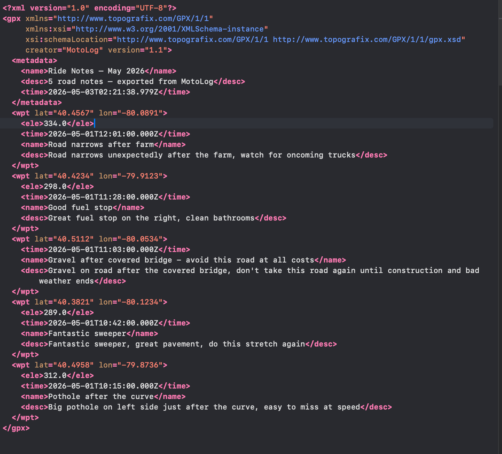
I’ve been iterating on the GPX output and attached an example file. Notes are editable after capture so I can clean up transcription and keep titles short enough to display cleanly — but the full description lives in the <desc> field.
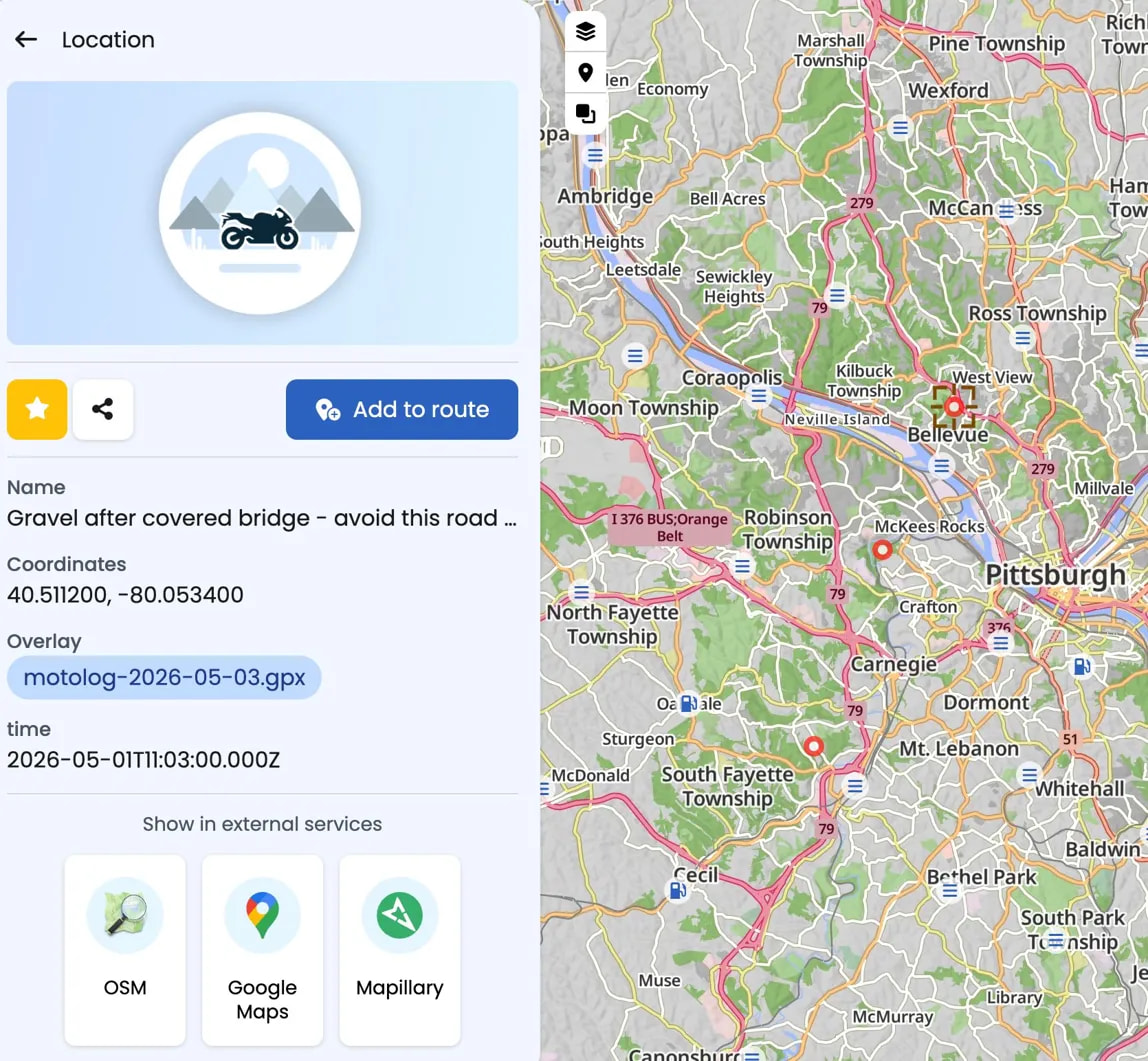
Which brings me to my question. When I load the overlay into Kurviger web, I can see Name, Coordinates, time, and the overlay source — but <desc> doesn’t appear to be surfaced. If I’m generating the GPX incorrectly please let me know and I’ll fix it — but if <desc> simply isn’t displayed, surfacing that field would make a significant difference. Even just as a scrollable text block in the location popup would give riders the full context of what they captured.
A couple of specific questions:
-
Which GPX fields does Kurviger currently read and display for overlay waypoints? I’d love a definitive list so I can structure exports to get the most out of what’s already supported — icons, categories, links, anything.
-
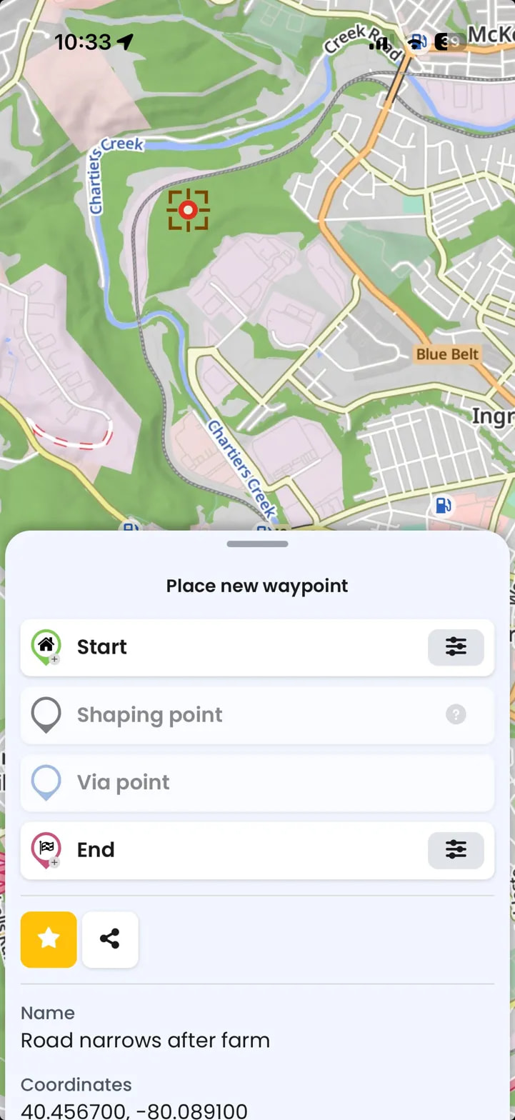
On mobile, tapping an overlay pin seems to trigger the “place new waypoint” flow rather than showing the location detail — unlike native Kurviger POIs which do load a detail view. Is that expected behavior or a known issue?
I saw this thread from last year which touched on similar ground — feels like there’s real appetite in the community for richer overlay POI support.
I’m a big fan of what you’ve built and would love to help grow overlay support for use cases like this in whatever way is useful — whether that’s providing test files, feedback, or anything else. Happy to share more about the app as it develops.
I’ve attached a couple of screenshots and a sample .gpx file
Thanks for building such a great tool for motorcyclists.