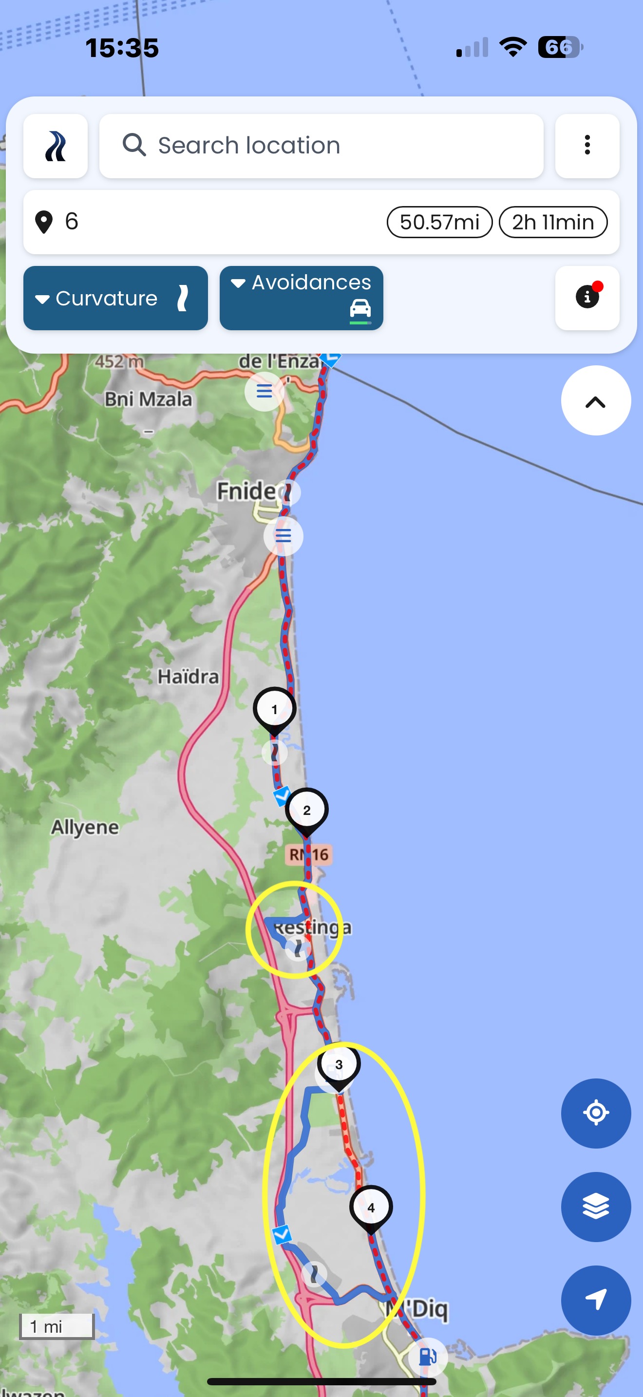
Can I ask why the application behaves so confusedly and tries to avoid the usual nothing special road at all costs. And sometimes the application takes you offroad even though you have set the fastest route in the application.
Usually because there is an inconsistency in OSM data. It would be helpful to post the links to your routes together with screenshots, if you wish someone to have a look at it.
I have tried to recreate the first screenshot, but cannot find the error in OSM.
@linux-user or anyone - help?
This is what I thought. But why doesn’t it exit this road on the previous roundabout. also before it is tagged as bicycles only.
If I move the shaping points to the opposite direction and reverse the route, also strange things happen:
Should we just explicitly add access for motor vehicles and see what happens?
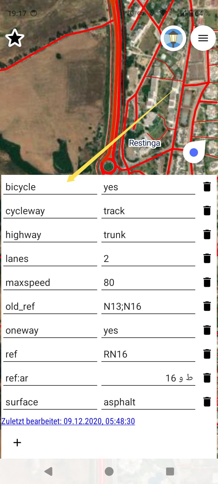
Checked on PC now. I am not 100% sure. I guess at a previous roundabout the bicycle is not set. The route follows this piece of the roundabout. As roundabout is implicit oneway it must use the next road. Then the route is trapped in oneways and must go ahead. At SP 5 finally a parking lot can be used (or the track before) and this is used then, until trapped again in oneways.
I think the bicyle = yes is not necessary. I guess cycleway=track is expressing this? Found nothing in OSM Wiki saying that additional access tag is required.
motor_vehicle = yes should also work.
@linux-user must decide. ![]()
I don’t think that it is related to the access tags.
Neither cycleway=track nor bicycle=yes should hurt.
I don’t think that motor_vehicle=yes would help either.
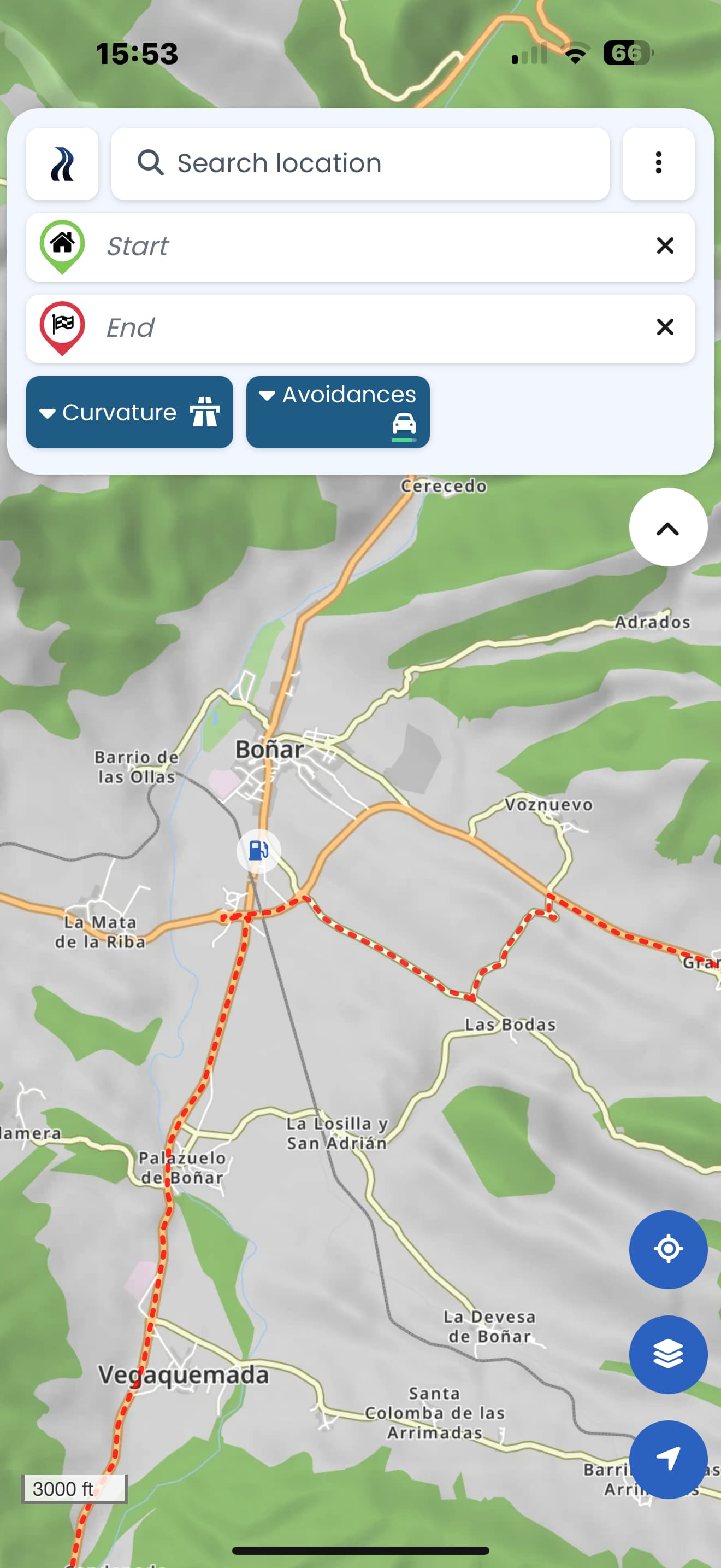
This route works up to the end - but not further ![]()
There must be something else that is blocking the route.
And here from start onwards it is working again.
And here at the end it is blocked again
This roundabout is completely tagged with motorcycle=no:
And also this road:
I have some doubts, if that is right - but I am not sure …
Edit: I put 2 notes on OSM:
No signs that forbid motorcycles can be seen on Mapillary. ![]()
Mapillary can legally be used as a source for OpenStreetMap.
I know Google can’t be used, but there is literally a motorcycle in this very roundabout on Street-View. ![]() https://maps.app.goo.gl/aGpo4roZRSY58tQN8?g_st=ac
https://maps.app.goo.gl/aGpo4roZRSY58tQN8?g_st=ac
I checked the OSM version history (Way: N13;N16 (30130644) | OpenStreetMap) and the guy (Whimsical Otter | OpenStreetMap) who put the the “motorcycle=no” tag was apparently using another tool (Kaart) for editing, so maybe he messed it up with a bulk edit. I ciuld imagine that the tag was intended for the bicycle track, but it was not done correctly.
Nach dem Offensichtlichen nicht gesucht .. Danke!
Zumindest beim Kreisverkehr .. ich komme aus einer Einbahnstrasse, welche noch benutzbar ist - und dann nicht durch den Kreisverkehr fahren zu dürfen, erscheint mir falsch bis unmöglich.
I’ve ran OT and those apper to be isolated entries. We could try contacting the author, but if there is no response, we could just remove them.

An other mapper solved my notes in OSM, but the route still has a suspicious deviation, because there was a further isolated roundabout with implausible tagging “motorcycle=no”:
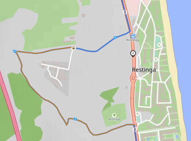
I removed that tags, I think in a few days the route of @ThinkBike will work properly …