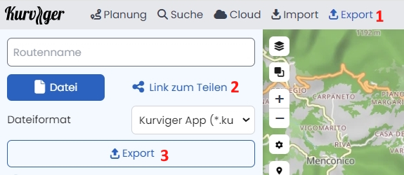
I export the route to be taken with the bmw app like this:
but with the gpx track created with these modes, the bmw app gives me incorrect and often dangerous information (e.g. making U-turns on motorways), the same route created with a different app on the other hand does not give me any navigation problems.
But the point is that I did the entire September and October tour of Turkey with Kurviger and I really don’t want to have to do it again. strong text
Hello,
If you use a Garmin BMW Navigator,
using the Garmin shaping point Format.
Next take care that all points were on the street.
See in the menue.
If you are facing more trouble, may the map is different between OSM and Garmin.
I’m using the BMW app on an android smartphone (I’ve tested it on two different smartphones, so it doesn’t depend on the device I’m using) and I don’t think it depends on the maps, because the biggest problems are on motorways. If I have to go from A to Z on a motorway using a track made with Kurviger, the app tells me to exit at exit B and then re-enter the motorway, when I get to exit C it lets me exit and then re-enter until I get to exit Z, but on normal roads it makes me take routes that are totally different from the ones set.
Anyway tomorrow I’ll try using the Garmin Shaping Point format and see what I come up with.
Okay - so you are using the BMW Motorrad Connected App ?
But it couldn’t be the tour from you screenshot
. . . . .
because there is no motorway … https://kurv.gr/REBkZ
If you provide us with the tour via
in the section before the motorway it was a continuous right turn, left turn or U-turn, in the motorway section at every motorway exit it told me to exit the motorway and skipping it told me to make a U-turn.
Today if the weather doesn’t improve I will try this route:
I’m going to try it with Garmin ShapingPoint export and the same track but edited and saved from Basecamp to see if switching from Basecamp fixes the track.
In the cable instead the weather improves, we’ll pop over to Siena.
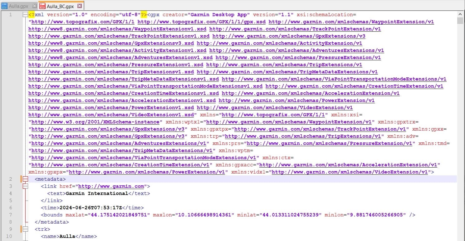
This morning before setting off when uploading the route, I realised that the tracks generated by Kurviger and not processed by basecamp, the bmw app sees them as xml files, whereas if they are processed by Basecamp the bmw app sees them as gpx files:
Where comes this screenshot from? It seems not to be the above mentioned BMW Motorrad Connected …
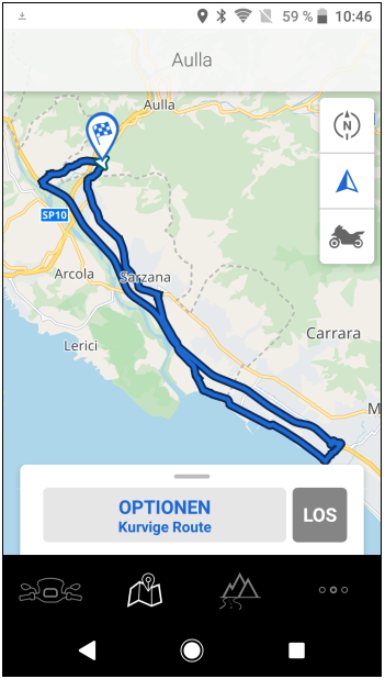
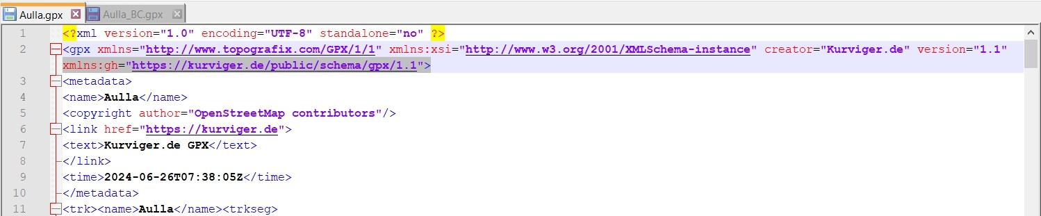
I’m curious and installed the BMW App (even I can’t connect it to my bikes) and your Aulla.gpx file works fine:
I upload tracks to a shared directory on google drive and in fact it is google drive that does not recognise tracks made with kurviger, however that screeshot is what you see when from the bmw app I import a track that is in the shared directory.
I didn’t exclude motorways on the bmw app, but even if I did when I upload a gpx track that route must follow, as for the track “aulla.gpx” on screen it shows up fine, the problem is when navigating it.
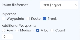
Today given the good weather we went for a ride in two to Siena, I prepared the route with Kurviger, exported the route in “garmin gpx” format and then modified it in Basecamp, but even in this mode the navigation didn’t go well, tomorrow I will make the last attempt export it in “google kml” format, import it into Basecamp and export it from Basecamp in gpx format, if even this attempt doesn’t go well, I’ll send the bmw app and the whole bmw navigation system to hell, also because there are the constant problems with the bluetooth connections between the bike, the phone and the intercoms.
Yes I have almost decided to get a zumo xt or xt2, I have to see what differences there are between the two devices and then decide from Kurviger what format should be used to export it to zumo.
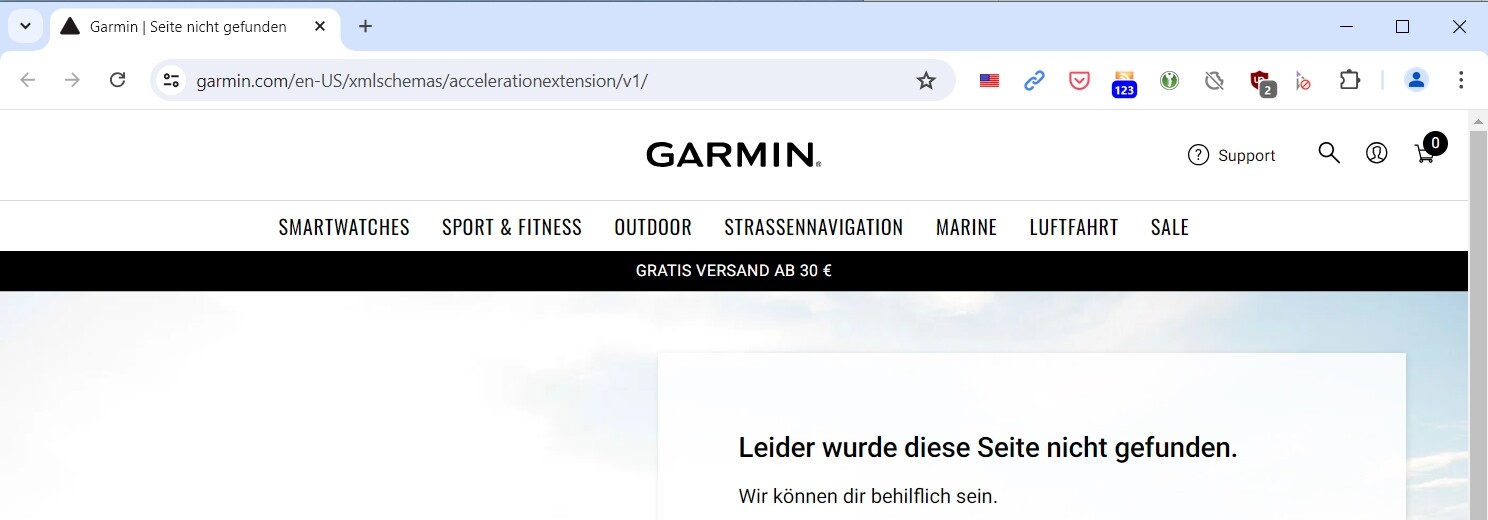
In the course of analyzing this “GPX track problem”, I looked at the header of the files from Kurviger.de and BaseCamp and discovered that the Kurviger file contains an URL that does not exist:
Links in XML don’t mean anything other than being “name spaces”. So you could add anything random, as long as it’s unique.
The use of URIs taking the form of URLs in the http scheme (such as XHTML namespace) is common, despite the absence of any formal relationship with the HTTP protocol. The Namespaces specification does not say what should happen if such a URL is dereferenced (that is, if software attempts to retrieve a document from this location). One convention adopted by some users is to place an RDDL document at the location.[5] In general, however, users should assume that the namespace URI is simply a name, not the address of a document on the Web.