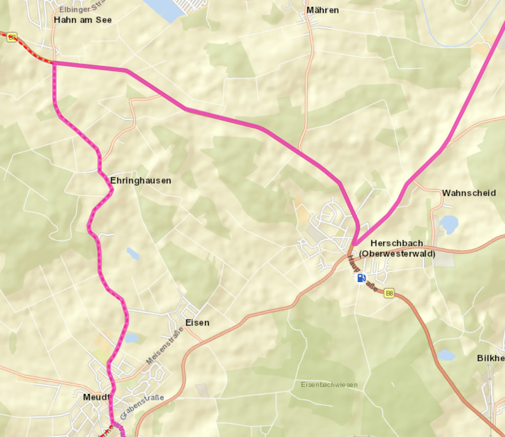
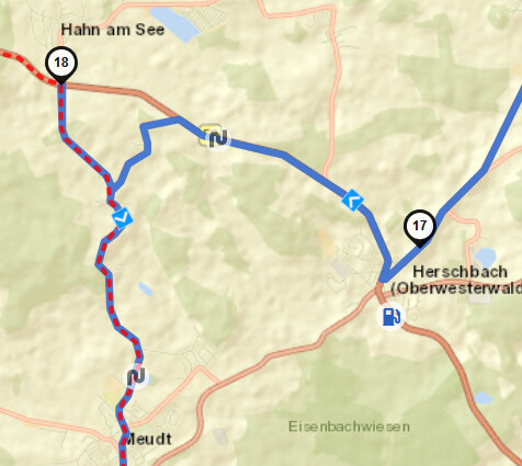
Just finished my first ride with the app on iPhone, and I’m comparing the recorded route. I recorded it with my TomTom Rider 500 and the Kurviger app.
In the process, Kurviger apparently “optimizes” the driven route. The large curve that I actually drove looks on the display of the Kurviger website as if I had taken a shortcut and then made a detour, there and back, to a waypoint.
That wasn’t how I remembered it. So I checked the TomTom recording. Everything is plausible there.
I find this an annoying “feature”. Under these circumstances, you can’t really share a driven route.
This optimization apparently happens when loading the route. In the view during selection, everything, at least at this point, is still fine.
Welcome to the forum,
The issue can be explained as follows: when importing the recorded tour as a route, the current settings are applied. In your case, you probably navigated using the curvy or fastest route option, but upon import, the setting was set to extra curvy, hence the discrepancy.
From my perspective, it would be very helpful if the GPX import is invoked when loading a recording. I would be able to see discrepancies and also fix other mess before sharing.
Similarly when I invite to a single recording or an entire folder.
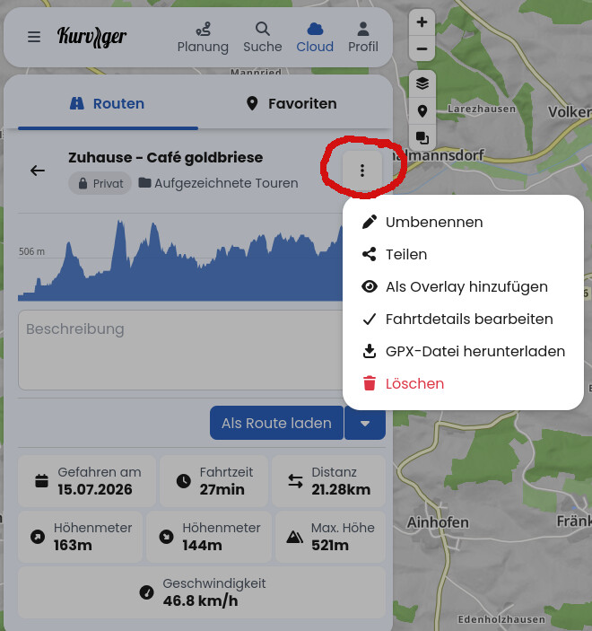
Since the import dialog could be annoying - two options: Load as route and Import as GPX.
Exactly. That might also be a slight misunderstanding at this point: as you wrote, you can see your tour recording „on the map“ during selection and you can also display it 1:1 on the map as a Map Overlay. However, if you load the tour recording „as a route“, it is a recalculated route and not your recording 1:1.
This is not quite optimal yet and can currently be bypassed quite well with @linux-user’s tip or by placing the overlay of your tour recording on the map in addition to the route recalculated from your tour recording and adjusting the (often minor) deviations with a few shaping points.
That may well be the reason. But it’s silly to change a tour on the fly that I want to import. I rode this route with a TomTom, using TomTom’s understanding of what is supposed to be curvy. That might well differ from what Kurviger.de considers it to be.
I planned the route with Kurviger.de, loaded it onto the TomTom, rode it exactly as planned, and now I can’t load it back in the exact same way? Nobody can convince me that this is a sensible procedure.
You can still load the original route, nothing will change about that! You can display the track from TomTom (meaning another system) as a map overlay on the map.