Message: Uncaught Error: coordinates must be an array of two or more positions - URL: undefined -Line: 2 - Column: undefined -Error object: {}
TET NL sector 6 geeft foutmelding
(Debug information, this helps us helping you, you can remove this if you don’t want to share this data, it should not contain any personal or sensitive information)
User Agent: Mozilla/5.0 (X11; CrOS x86_64 14541.0.0) AppleWebKit/537.36 (KHTML, like Gecko) Chrome/152.0.0.0 Safari/537.36
Cookies Enabled: true
Screen: 1181 x 664 px - 1.625740885734558dppx
coordinates must be an array of two or more positions. I’ve had the same problem a few weeks ago. It was solved by the forum (they worked on the file). Is there a way i can do this myself instead of asking each time the forum to help? Thx!
(Debug information, this helps us helping you, you can remove this if you don’t want to share this data, it should not contain any personal or sensitive information)
User Agent: Mozilla/5.0 (Windows NT 10.0; Win64; x64) AppleWebKit/537.36 (KHTML, like Gecko) Chrome/153.0.0.0 Safari/537.36
Cookies Enabled: true
Screen: 1280 x 720 px - 1.5dppx
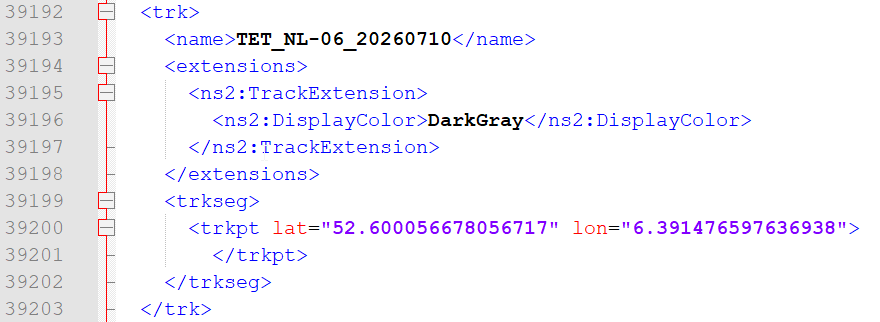
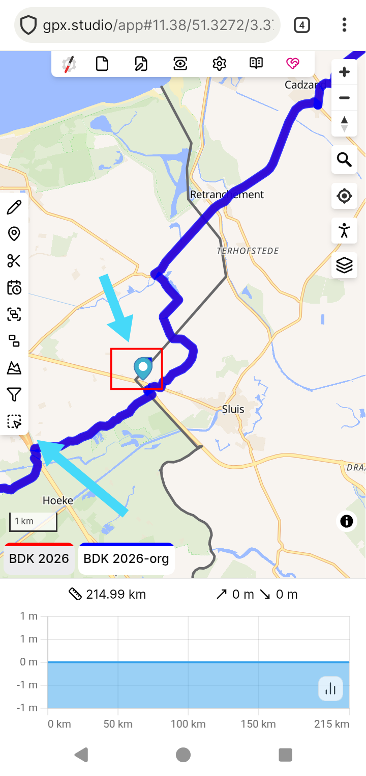
This a file from Garmin. Garmin or Basecamp have the possibility (as far as I know) to place POI independant from the Route or track. Kurviger cannot use these extra points this way. As in this file there is such an extra point - and only one - this error appears.
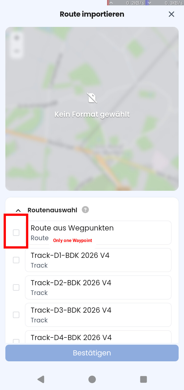
When importing Kurviger tries always to create a route. As there is only one waypoint (the rest are track segments) it is impossible to create s route from waypoints, you need at least two points.
It would still be some kind of nonsense, as these are intended to be extra points, but this can be handled in the import dialogue.
Or as @zaphod_42 above open the file in some editor. I would propose the notepad++ @zaphod_42 uses https://notepad-plus-plus.org/. Have a look on some gpx and you will also get a feeling, how gpx works. Download plugin for XML. It is all free.
Yes. I tried yesterday with a another app, and the point was just ignored. It worked, but it felt not really perfect, as data is “lost”.
Another option could be to still display the data, but remove the checkbox, as not possible to import. The user has the hint, that some data of the gpx cannot be used. The user can open the gpx file, copy the coordinate and check.
Another option could be, that in this special case with such a single point, that the route / tracks are imported first. Then this single point is added in the last step as waypoint as best fit. When checking the deviations, the point would cause a big one. But at least it is not lost.
As in the screenshot above, the “Route” would be selectable - but with the hint "Single point will be integrated into the route. I am not sure, how confusing this would be.
The single point could be shown in the preview, when checkbox is acivated.
Another option could be that the single waypoint is imported as a favorite (automatic creation of folder with name of the import file, insert waypoint, activate overlay).
Would be even cool, when there would be an option to save all waypoints wpt to such a favorite folder?
But I guess it is still a rare case and probably only related to Garmin / Basecamp? Your idea - ignoring - seems to be the easiest one and sufficient and the gap should be closed. One error message less and less confusion for users.