I’ve noticed that the reported GPS position in Kurviger is always trailing a good few seconds behind where I actually am on the road. This can cause real problems at complex junctions.
The rest of the app is quick and responsive. I’ve tried using the two different Location Services (Google & Android) with no difference. I can switch to a different navigation app and the problem goes away, so this seems to be a Kurviger issue.
Hi Kira. Yes my location accuracy is set to high and there are no battery saving options applied to my phone or the app.
The accuracy and smoothness of the GPS tracking is fine, it’s just the position is consistently lagging behind the real location. Other navigation apps on the same phone don’t experience this problem.
For my next journey I am will try:
Location Permission = Always (rather than “while active”)
Enhanced Processing (phone settings) = On
But there’s no reason these should cause GPS position lag.
Something to consider: is it lacking behind while moving, or do you perceive this also while standing still? I guess there can be different interpretations where at the arrow you are positioned. At the tip or in the center of the arrow?
Unfortunately it’s a lot less subtle than you are imagining. If I exit a sharp corner into a straight, I can look down at the Kurviger app, slowly count, 1, 2, 3, 4 and the position arrow is starting the corner. It’s following my movement exactly, just several seconds behind.
Because the map is orientated to the direction the bike was travelling a few seconds ago, it makes roundabouts and angled junction difficult to interpret. Side roads that are close together also become guesswork.
I saw the same topic on this forum from a few years ago, but it didn’t contain a solution. Is this a common problem for Kurviger?
The location is precise when standing still or moving slowly.
The faster you accelerate, take corners, or move, the more inaccurate the indicated position becomes.
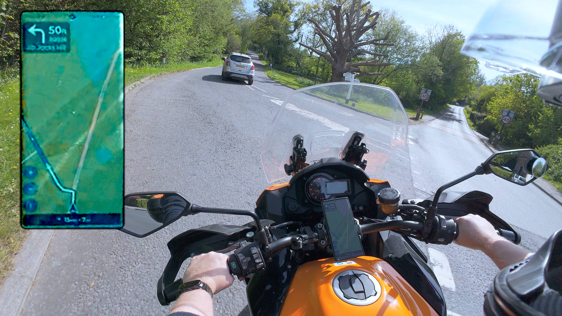
The above picture is at standard map zoom level. While travelling slowly around that corner the positional arrow is about 2cm behind where it should be on the screen - which takes roughly 3 seconds to travel.
Zooming the map 3 times larger, the arrow should now be 6cm behind to represent the same 3 seconds of lag, but that isn’t what happens. The arrow STAYS at 2cm behind, which is now only 1 second of lag. If you zoom in far enough the lag becomes essentially zero.
So the lag isn’t time, it’s pixels. The position arrow is in the wrong place on the screen, which throws off the movement and rotation of the map.
As the bike slows down to a stop, the map & arrow snap/slide into the correct position, making the problem difficult to spot.
I’m wondering if this might be a screen resolution issue. Is it possible that the Dev team just aren’t scaling the offsets properly, placing the map & arrow in the wrong position while moving.
My phone has a 1440 x 2960 screen and I’d be curious to know what the other people experiencing this problem are using.
The bottom line is that this doesn’t happen with other navigation software on the same phone, and no hardware or software settings have altered the problem. Kurviger is easily the best navigation software I have used, but the Dev team might need to roll up their sleeves on this one.
Unfortunately, after more testing today the results seem less clear. There still appears to be a lot less “lag” when the map is zoomed in, but the amount was less consistent this time.
I thought I’d found a simple answer, but there seems to be other factors involved.
iPhone 11 without a SIM card as navigation and iPhone 15 as a hotspot. If I’m connected to the hotspot, it slows down after a while; if I turn off Wi-Fi, everything works fine again.
I don’t know how it works on Android, but the iPhone also uses Wi-Fi connections (and cell towers) to determine/improve location accuracy.
My situation is probably different from yours, but out of curiosity, try turning off Wi-Fi as well.