Just simple question.
How to avoid a specific road when planning a route? I mean a road that is currently impossible to travel on, or I simply don’t want to.
Or why can’t do it in the Kurviger?
Just simple question.
How to avoid a specific road when planning a route? I mean a road that is currently impossible to travel on, or I simply don’t want to.
Or why can’t do it in the Kurviger?
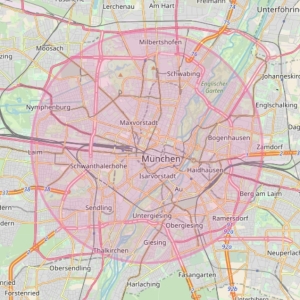
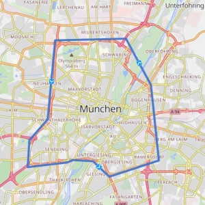
In BRouter you can define “No-Go-Areas” either as Circle with a specific radius or also as polygon:
Would be great if Kurviger could implement it.
The avoidance function is still missing in the current version but is on the roadmap. It is not yet possible to say when it will be available.
Thanks!
But, when “it is not yet possible to say when” - it’s not roadmap, it’s backlog. 
We don’t publish any dates for features in general.
I have one thing, that always is a lot of work: I do not like to travel through city centers, e.g. I will ride to my working office (170kms, do it 2 times a year), and always I will be routed through the center of Mainz. Also other routes are sometimes through city centers, where I don’t like to go.
A good function for this would be to define areas, where you do not want travel, no matter, if it’s shorter or “better”.
Is that possible in any way?
Hi Oliver,
may you please provide a sample route as Kurviger link? 3-dot-menu → share → copy link to share - then we can have a deeper look into this.
Normally Kurviger avoids driving through cities directly, only if you put a waypoint there or if you have switched on too many avoidances this behaviour occurs.
I guess he wants to have a nogo-area, for example something like a limited area for environmental reasons (DE “Umweltzone”). Or a nogo-way.
This was discussed somewhere, can not find it. As far as I remember - should be on the list, but as always, no date for features.
Ok, here it is:
Problem: Only setting it to highest “Kurven” level avoids citys. When using moderate (says; avoid cities), ist does’ntv really do it. When driving from Neu-Anspach to Darmstadt, also only highest Level avoids driving through Frankfurt.
But what I read here, ist a good question: How to avoid some roads, because they are blocked at the moment? We have had some of these in the last time… and driving around when you get there is really annoying and sometimes it takes really a lot of time and often driving back a good way…
Or another thing I found on one Route… I was going from the Bodensee to a friend, and I always got directed to travel through France (area of Karlsruhe)… what I did not want to. I had to set some shaping points to get it right…
This would be a very big nogo-aera. Or another type of avoidance “Avoid Country = ‘names’”, "Avoid City = ‘names’). Sounds funny at the first moment, but I have also some areas I just ha.. oops, do not like. Set France to nogo is a mistake. 
On the other hand, when you visit your friend often, why not create a route once and save it?
You pointed me to an idea. I just created a favorite folder “Avoid”, and will create some points around the aera, then I can re-use it with a click. Thanks. 
Of course this is a “big” Area… but I only need something to avoid a small area in this case of france.
And yes, I made a route, that I can use in the future… but it should be possible to just avoid some areas, for whatever reason.
Hello, rider from Israel here.
Just bought the subscription and really enjoy the app.
However…
No-go areas is a very needed feature here in Israel.
Kurviger is buillding a great round trip from my home, but as Israel is a small country it adds roads in West Bank, that are not really safe to drive with the Israeli license plate.
If there will be a way to exclude specific localities or be able to “avoid the road” in already built route it wouldd be perfect.
Thanks!
No-Go Areas and more blockage options is something we have on our todo list, currently this is not possible though, sorry. Please double check the routes before you leave and stay safe. You might want to disable rerouting to avoid Kurviger recalculating a new route.
Thanks for the fast reply, I saw your previous answer, but decided to post as there is no “me too” button for showing the interest.
Cheers and thanks for the app!
Hello
Following up on the No-Go-Area discussion here — I’d like to suggest a closely related but slightly different angle: instead of (or in addition to) area/polygon-based exclusion, a persistent, road-specific avoid list tied to the user account.
The gap
Kurviger already handles road-type avoidances (unpaved, main roads, motorways, ferries, toll roads) with adjustable strength, and per-route detours via shaping points or a forced beeline. What’s missing is a way to say “I never want to be routed over this specific road/section again, for whatever reason, until I remove it myself” — without redrawing a polygon or re-adding shaping points every time I plan a new route.
Why road-specific, not just area-based
A polygon works well for something like an environmental zone or a region you want to avoid entirely. But a lot of personal “never again” roads are single stretches inside an area you otherwise ride through all the time — chronically bad surface, heavy farm/commuter traffic at certain times, a bad reputation for speed enforcement, or simply a road you tried once and didn’t like. Blocking the whole surrounding area to avoid one road throws away a lot of otherwise good routing options.
Proposed feature
This would sit alongside the area-based No-Go idea rather than replace it — areas for zones you want to avoid entirely, a road list for the specific stretches you’ve personally ruled out over time. Curious whether this distinction is useful for how you’re scoping the feature internally.
Thank your very much
Hi @hk199,
Thanks for the input! That is something we already thought about too. I think it could be a way to further individualize route planning. Maybe that is also relevant for areas you ride often and want to avoid riding some routes repeatedly. I think there could be many possible reasons and usecases for a function like that.
@kira - just throwing in some ideas:
In the US, the shipping company, UPS, creates a route for each driver before they leave. They disallow left hand turns and avoid stop signs and traffic lights. This saves fuel and reduces the accidents their drivers are in. I imagine they have dangerous intersections too.
The left turn is brilliant. You don’t have to cross traffic to go the direction you want. On some roads, only one direction has a stop sign so it can be dangerous to cross.
When I layout routes, I will often tediously put waypoints around things like this. sometimes it is worth the extra time for safety and stress reduction.
@t00thl355 Thanks for the ideas. We’re still thinking about how something like this feature could work in practice, though. One of the questions we would need to solve for a feature like that is how personal avoidances should interact with routes that are imported or created by someone else.
One of the things we really value is that you can share a route in Kurviger and have someone else follow the exact same route.
Thanks for sharing your experience @Tom_Buskey . That approach certainly makes sense in the context of UPS. For Kurviger, I think combining finding enjoyable twisty roads with rules like avoiding certain turns would probably get quite complex. Still, interesting to hear how you currently handle these situations with waypoints.
Garmin has this function. On my Zumo XT2 I can set avoidance areas or roads, and the same is true within the old, obsolete Basecamp software. This functionality would be such a huge benefit to route planning. I would be perfectly happy coding this capability for you if it means that we gain that benefit as a community.