A lot of distritbuted GPX (from friends, in a forum or elsewhere in the web) are Garmin GPX.
Inside this GPX in Garmin format frequently the calculated route is inserted in the GPX route with Garmin special extensions.
An example I found in the web:
Franken-Thueringer Wald 2010.gpx (271,3 KB)
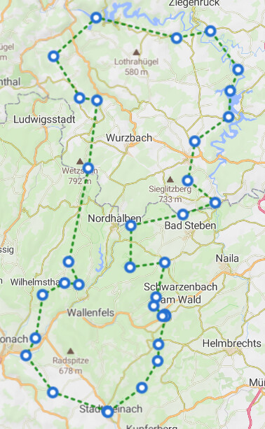
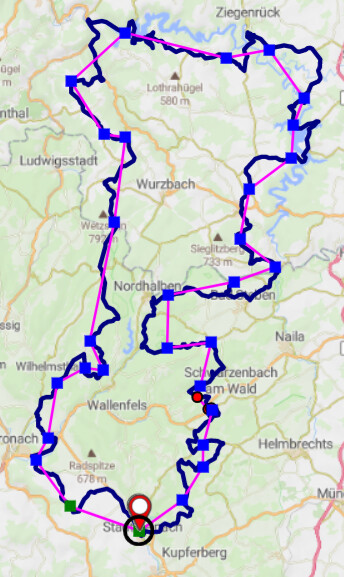
If you import it in Kurviger, only the route points (tag <rtept>) of the GPX are used (as kurviger waypoints) - to show that, I imported the GPX only as overlay in Kurviger (1st picture). But there is much more info in the GPX, you can see that if you open that GPX in gpxshaping.de (2nd picture): The magenta line shows only the connection between the route points, the blue line shows the additional info contained in Garmin specific extensions:
You can export a new GPX from gpxshaping.de (it contains the blue line as track) and import that in kurviger, so you can see also the “track” hidden in Garmin GPX extension before:
Franken-_Thüringer Wald_2010Shp.gpx (149,6 KB)
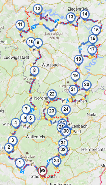
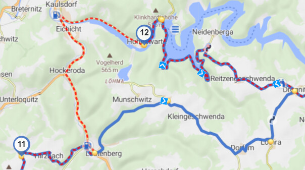
As you can see, there are several differences between the Garmin route and the Kurviger route - you can fix that by adding further waypoints, for example between #11 and #12:
(gpxshaping.de can do that automatically - but that is OT here)
From my point of view it would be helpful, if Kurviger also reads that Garmin extensions, because (as mentioned before) a lot of GPX you get via web are in that format.
The format is quite simple, as an example I attached the route point “Straß4” from GPX below.
Each route point (tag <rtept>) contains further points (tag <gpx:rpt>) showing the track to next route point, so it is not difficult to extract that points and build a track from the route points and the “track” points between:
<rtept lat=“50.2757549” lon=“11.6003180”>
<time>2010-05-24T18:41:22Z</time>
<name>Straß4</name>
<cmt>Straße</cmt>
<desc>Straße</desc>
<sym>Waypoint</sym>
<extensions>
<gpxx:RoutePointExtension xmlns:gpxx=“http://www.garmin.com/xmlschemas/GpxExtensions/v3”>
<gpxx:Subclass>00d000000000ffffffffffffffffffffffff</gpxx:Subclass>
<gpxx:rpt lat=“50.2757549” lon=“11.6003180”>
<gpxx:Subclass>06006bb87a00248d0500211600006c000000</gpxx:Subclass>
</gpxx:rpt>
<gpxx:rpt lat=“50.2757549” lon=“11.6003180”>
<gpxx:Subclass>06006bb87a00658d05001f02070068d26100</gpxx:Subclass>
</gpxx:rpt>
<gpxx:rpt lat=“50.2757978” lon=“11.6005754”/>
<gpxx:rpt lat=“50.2757120” lon=“11.6006613”/>
<gpxx:rpt lat=“50.2753258” lon=“11.6007042”/>
<gpxx:rpt lat=“50.2749825” lon=“11.6008329”/>
<gpxx:rpt lat=“50.2745104” lon=“11.6011333”/>
<gpxx:rpt lat=“50.2740175” lon=“11.6015559”>
<gpxx:Subclass>06006bb87a00658d05002117000014000000</gpxx:Subclass>
</gpxx:rpt>
</gpxx:RoutePointExtension>
</extensions>
</rtept>