The leaves are falling, winter is near, less motorcycling, more time left for new stuff. So I thought could be a good idea to make a short introduction for OSM-starters for the apps StreetComplete and SCEE.
StreetComplete is a really great tool for quick contributions, which everybody can use with nearly zero knowledge. SCEE is based on StreetComplete, and has very advanced features, what requires some more experience.
Please only map what you see and not what you guess. Do not use data from any other services, like Google, it is not allowed by Google or (most) other providers.
Happy mapping.
Example: Maintaining the surface of roads.
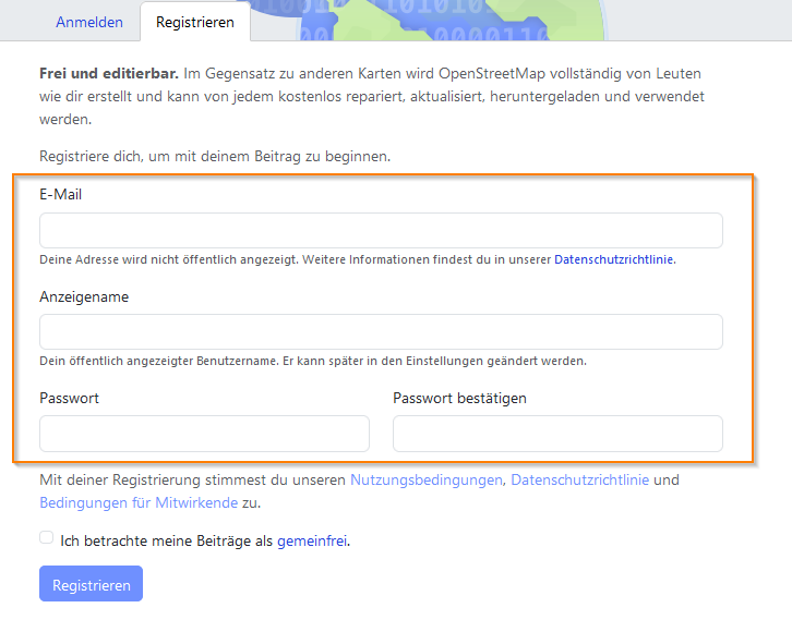
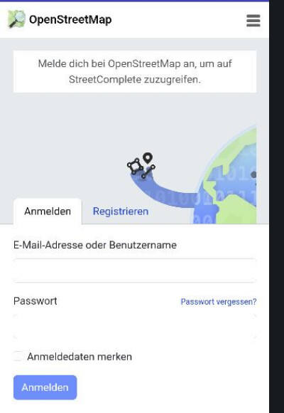
Create an account on OpenstreetMap
Go to …
… register a new account …
… read the conditions, confirm and enter your data.
Install StreetComplete from Google-Play-Store
Open the app and login …
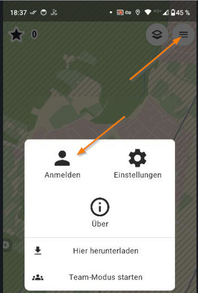
… with your OSM-data. Confirm, that this app may access your account data.
Recommended settings
At least what I recommend.
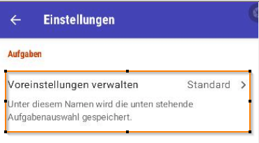
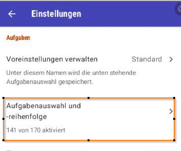
Open the settings …
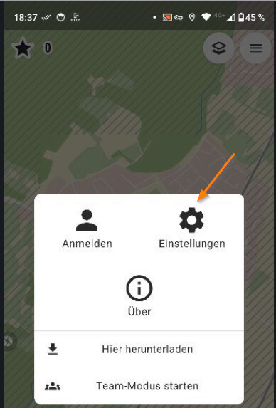
… choose first entry to maintain the set of quests you want to contribute to.
Duplicate the standard set of quests …
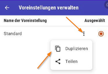
… and create a new set. I give it the name “Nichts/Nothing”, so no tasks for this new set.
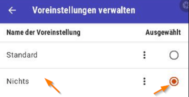
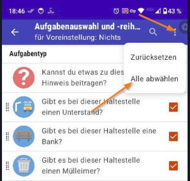
Now select what quests should be in the new set.
As I want this set to be empty, I deactivate all checkboxes. Go one step back to save.
Your set should be displayed like this. One quest cannot be disabled, this is fine.

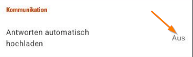
Another - from my point - very important setting: Disable uploading your contributions immediately.
This means you collect and enter your data, then at some point you press a button to upload the changes. This way you are able to undo your entries before uploading. All your unsaved entries are saved in the app, even when you close the app and nothing gets lost.
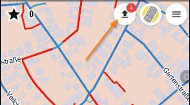
We are ready to start with mapping!
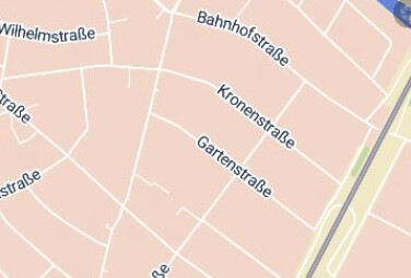
Select the area on the map. In case there are stripes on the area, latest data is not yet downloaded from OSM. Download the data.

No stripes, perfect.
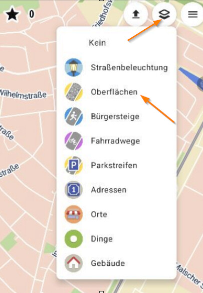
I want now to maintain the surface of roads.
Activate the special overlay to contribute to surfaces.
When using overlays, red is marking missing data.
- red - no surface maintained
- other color - some maintained surface, blue is for asphalt

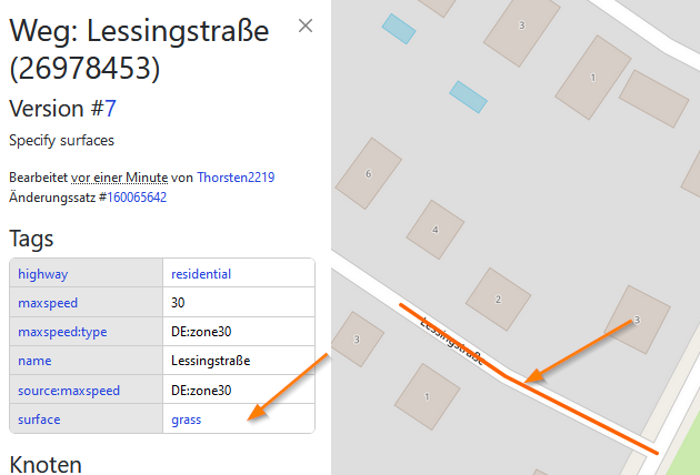
We click one road and check the data.
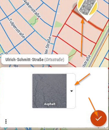
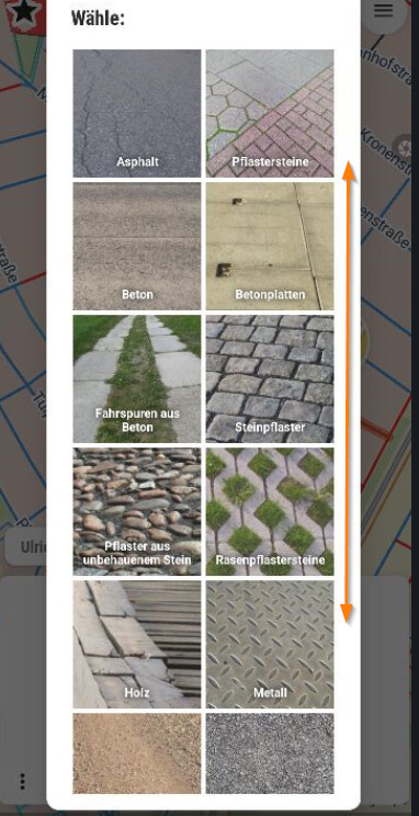
Opening the selection shows some examples of surfaces. The list can be scrolled. Choose the best fit and confirm your entry.
That´s it. ![]()
–
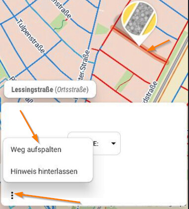
Split roads due to different surfaces
There can be different surfaces along the road. With StreetComplete you can split a road into segments. The properties of the segments are copied. Each segment can - or better must - now be maintained separately with different properties.
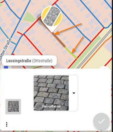
For example this road would have grass and pebble stone.
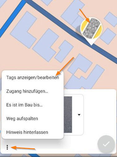
Click the three-dot-menu and choose the function for splitting …
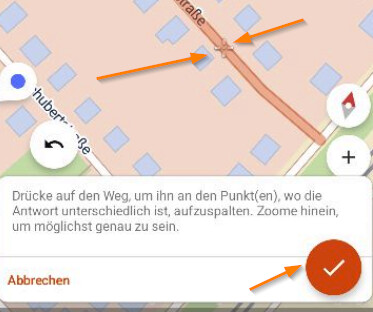
… zoom as near as possible and press with the finger the correct postion. The spli-position is marked with a cross. Confirm the split.
It is now possible to maintain each segment. You see the different colors representing different surfaces.
That´s it. ![]()
Undo
In the left lower corner there is a button to revert changes. Follow the instructions.
Note: The undo is only possible, when you have not uploaded your changes.
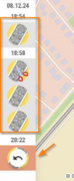
Upload your changes
Press here. We have done 4 changes. The number decreases to zero, while it is uploaded to the OSM-Server.
That´s it. ![]()
How long does it take, until it is visible on OSM-maps
It takes only 1 or 2 minutes.
Open your browser and log in into openstreetmap, check your latest changes.
We see here the splitted road with surface = grass.
Note: I have reverted the changes for this demo already.
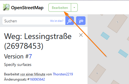
Edit in Webbrowser / ID-Editor
Here you can start edit the map with the ID-Editor (just as a hint, there is lot of documentation about the ID-Editor).
App SCEE - StreetComplete Extended Editor
SCEE is a partner project of StreetComplete and the developers are involved in both projects.
I would recommend to use SCEE, when you have at least some experience, read some docs and want to contribute regularily.
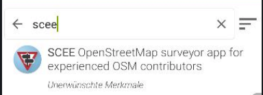
SCEE is not available on Google Play Store (at least I do not find it), probably they do not want that everybody uses it without experience.
Install the app F-Droid. F-Droid is an app store like the play store. It concentrates on free software.
When your phone warns you, that this app store might not be trustworthy, confirm that it is trustworthy. I use apps from F-Droid as long as I have a phone and never experienced or heard any negative about it, and never had issues with the apps installed from F-Droid. At the end it is your decision.
Search for SCEE. Choose and install.
Settings
When you install SCEE, it behaves exactly as StreetComplete. Check above the recommended settings for StreetComplete.
Additional setting
Activate the Expert Mode:
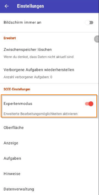
When you are in the Expert Mode, you get a lot more of options.
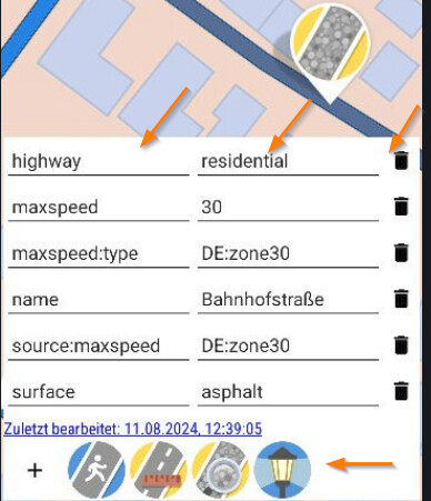
You are even able to edit the tags directly, if want. This means also you can delete entries. Please be careful. In the lower area, the app proposes addtional properties. The idea is: As you are here at just this place, so please add so much information as possible.
That´s it. ![]()