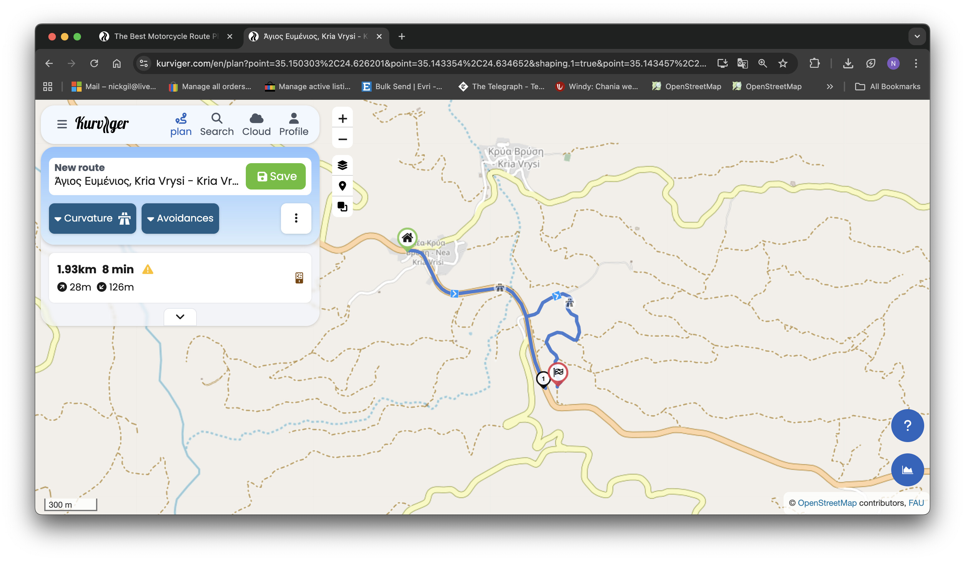
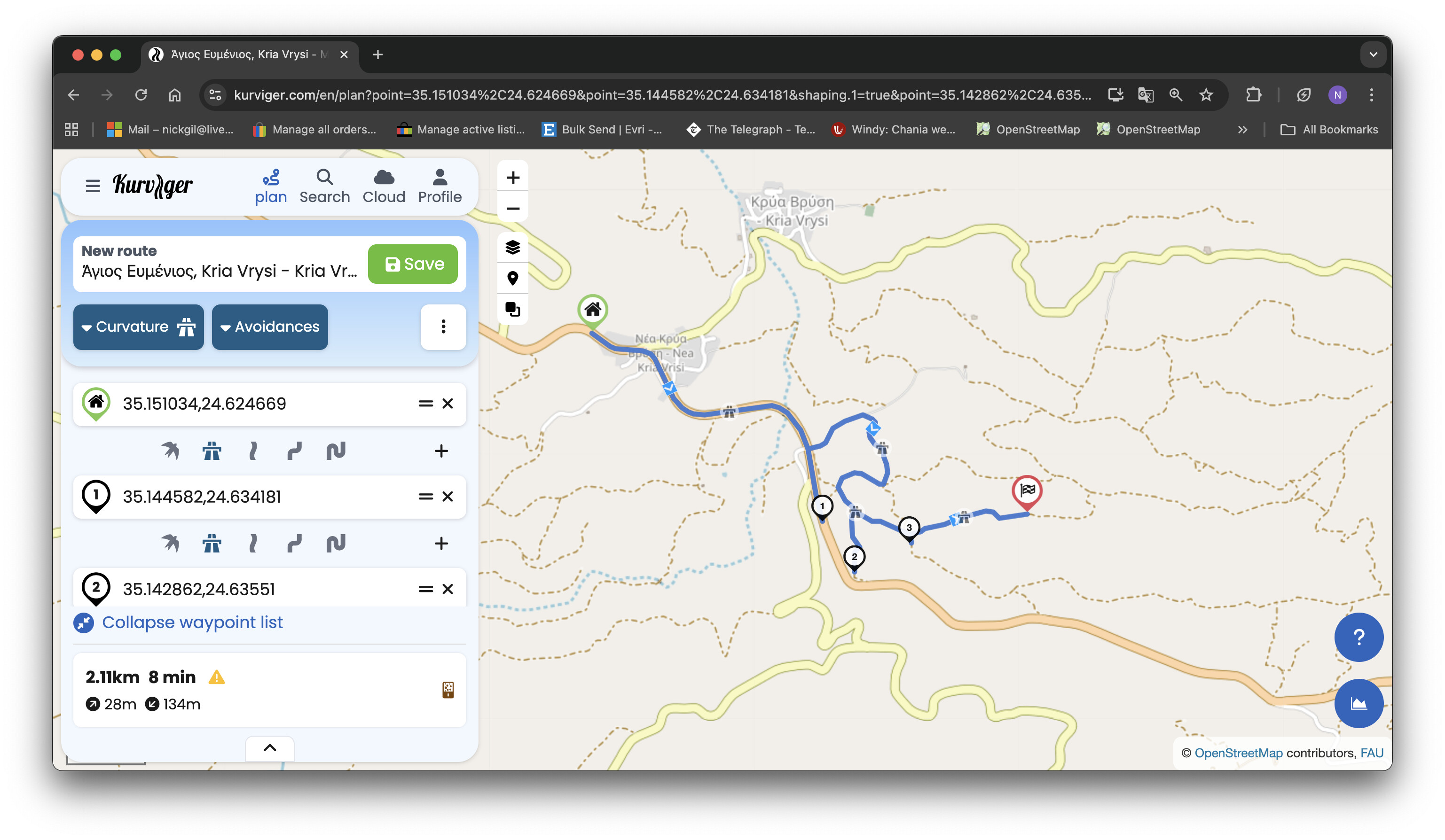
Hi there, trying to plan a route,
create route successfully.
re-import route into kurviger desktop to check.
shows deviations.
trying to plan a routecant extend route anymore successfully
cach and cookies clear for 'all time"
route set to fastest
no avoidances ticked
please help this is driving me mad and i have a big trip in a few days
cannot see how to add photo!!
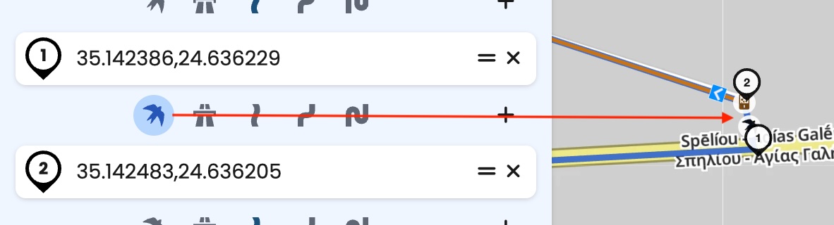
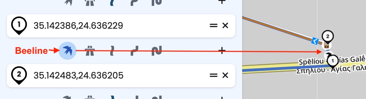
take this https://kurv.gr/WEvcF - you can help yourself by using beeline for a short distance
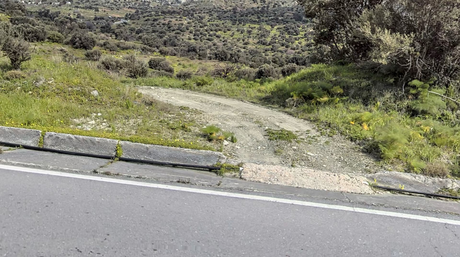
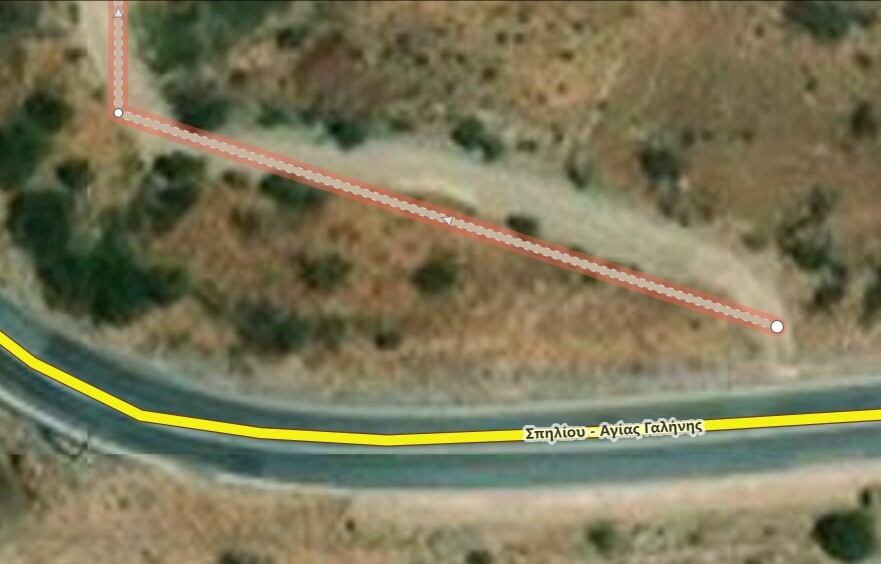
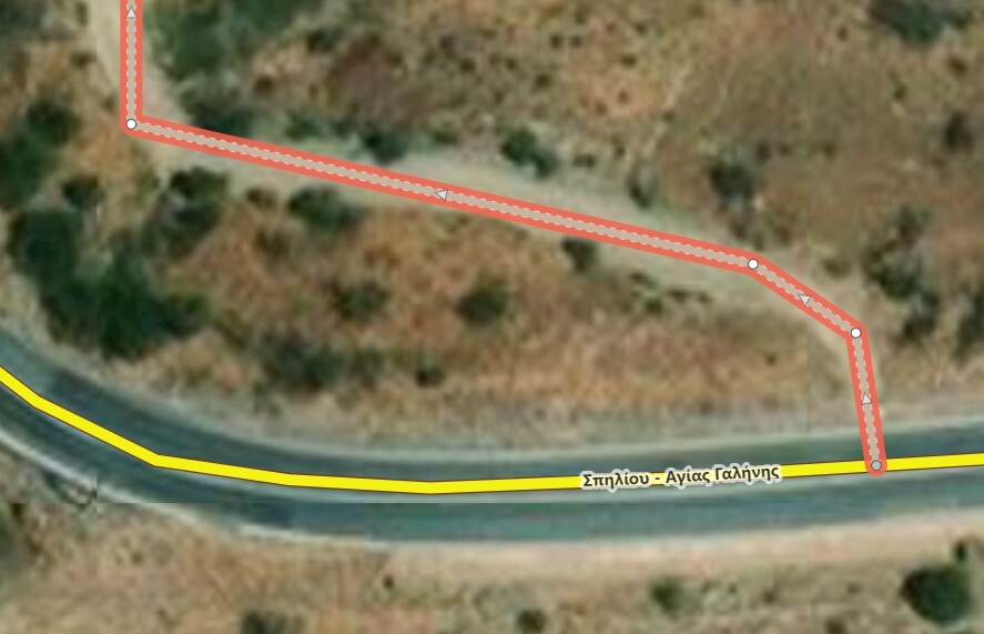
The gravel path wasn’t connected to the road - I changed it in OSM:
Thanks for correcting it,i tried a couple of routes i will check them in osm to see if they are connected or not.
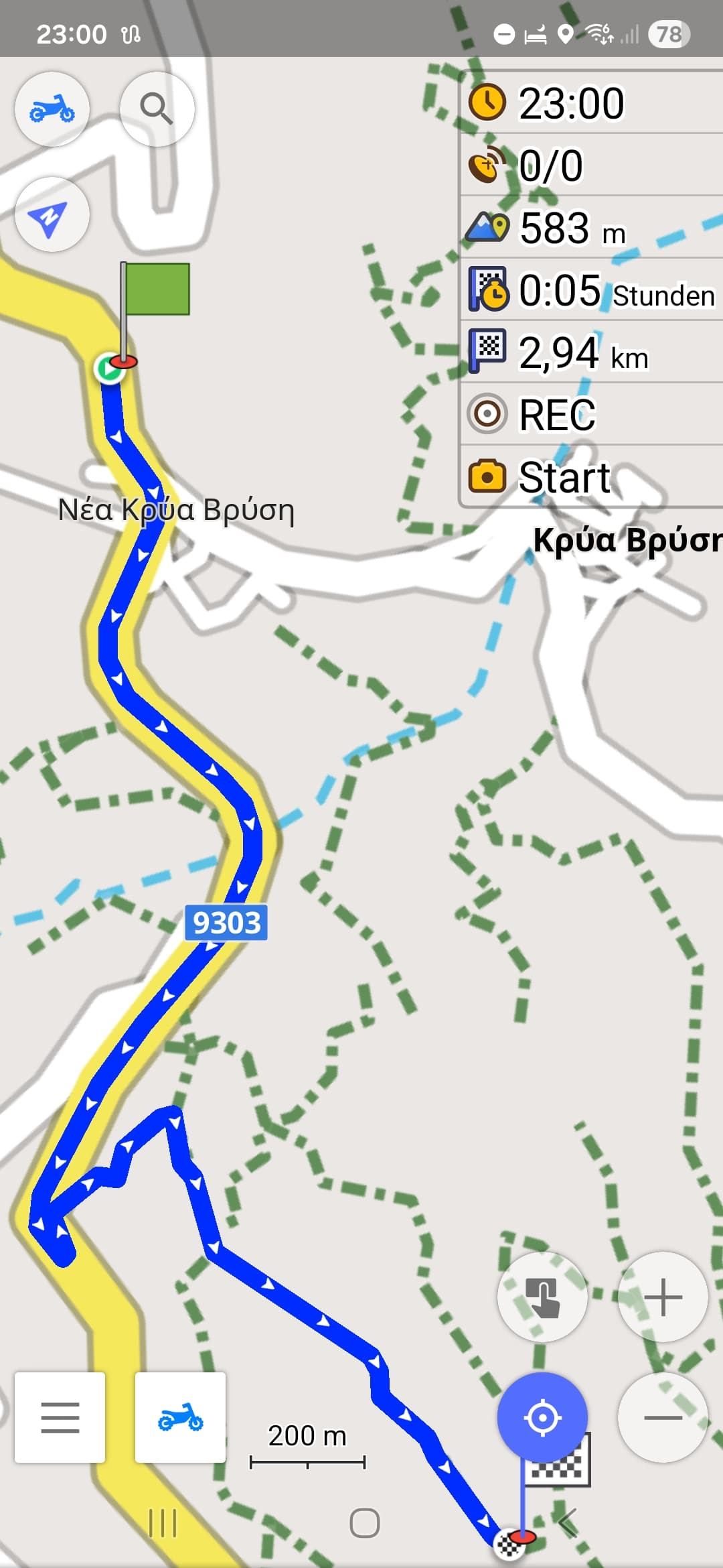
Your photo is very clear,is that google street view or another source.if so which one please??
and how do you use the "beeline "function i never tried it before
Thank you to all who helped