Limited Overlays

I changed from calimoto to kurviger.

But I still want to see al my tracks (not routes) in an overview, which technically is possible with obverlays.
BUT overlay are limited to 15!
Why the hell?!?

The is really a disgrace.

Will kurviger change that?!

You can add a whole folder as one overlay. Does this work for you?

Goto Kurviger Cloud -> My Routes

Too much overlays may affect performance. To my experience 15 is a lot. Each folder can have a lot of routes.

Edit: Forgot to say. Same with folders of favorites.

Did you read that?

It is a reasonable design decision.
As @Toffel mentioned, one folder and even a GPX file can contain large amount of data which can lead to app lagging.

Imagine if there was no limits - some users would add overlays like there is no tomorrow without ever removing them. Then, they would complain that the app is too slow without thinking about the cause. Not a great scenario.

With the limitation, the user is forced to think “do I really need all of this now?”.

I guess, Kurviger team would increase the limit if they are convinced that many users really need more than 15 overlays, but even then it will probably not be unlimited.

I hope you can find a good way to organize your tracks and display them within the current constraints and if not, it would be helpful to explain where your needs collide with the restrictions (e.g., how do you store and archive your tracks, how would you like to have them displayed in an overlay etc.).

Currently, importing tracks (without converting them into Routes) is not supported by Kurviger, so maybe this would be a possible future fix. Other possibility would be to merge all your tracks in one big GPX file and add it to the overlays.

1 Like

Try gpx.studio — app. Help for merging gpx.studio — help | Merge.
Just merged four tracks into one file.

GPX with four tracks.

Overlay in Kurviger:


Perhaps also with https://gpxshaping.de, not tried.


I have created a oneliner for the command line. Unfortunately only for Linux with gpsbabel and gawk. Perhaps there is someone out there who is able to do similar stuff for Windows; I am not experienced with scripting in Windows.

  • Create a folder
  • Copy your gpx-files in the folder

Create an output folder:
mkdir merged

Run this oneliner inside the folder with your gpx-files:
ls *.gpx | gawk 'BEGIN{ cmd = "gpsbabel -t " } { cmd = cmd " -i gpx -f " "\"" $0 "\"" } END{ cmd = cmd " -o gpx -F ./merged/Merged.gpx"; print cmd; system (cmd); }'

The onliner takes all gpx-files in the folder, combines the filenames as input-files to the gpsbabel command. All files are combined into the output file “Merged.gpx” in folder “merged”.

Generated command executed:
gpsbabel -t -i gpx -f "1.gpx" -i gpx -f "2.gpx" -i gpx -f "Muenchen.gpx" -i gpx -f "Tour vom 24.05.2025.gpx" -o gpx -F ./merged/Merged.gpx

Four tracks in the Merged.gpx as expected.

Overlay in Kurviger looks also fine (so far with my testcases).

I’d like to have all tracks visible at one sight. Which is possible in Calimoto (pic) or Mytracks.
As I understood, in kurviger this is possible only with overlays - but not with a restriction to 15 …
And I’d still ike to have each tour in one folder, with several (day-) tracks in it.

I have used Calimoto only within a short trial period and gave noticed the lines (tracks) like in your screenshot above, but I am not very familiar with the app. Where is the data for these tracks stored and can you switch them on and off individually? Does Calimoto also use the cloud to store the routes and tracks? How can you add the tracks that you recorded with other apps to this overview?

Kurviger currently uses a special folder (“Tracked rides”) for storing the tracks:

If you add this folder to your overlays, you will get a very similar representation to that from your Calimoto screenshot.

There have already been several different proposals to improve file management in Kurviger cloud, so I guess there will be some changes as soon as the team works out a sustainable concept and finds time to implement it. Until then, we’ll have to live with those restrictions and give the developers useful inputs.

2 Likes

From my point of view 15 overlay x 300 planed routes = 4500 is not bad
Add 1000 Tracks you already ride.
Average track/route may 250km
You can see > 1.3 Mio km at once.

1 Like

Thank you.
Yes, Calimoto is also cloud based, tracks can be stored (routes & tracks) and you can edit them as gpx, kml and itn.
But you can’t manage driven tracks in separate folders - there is only one, like the “tracked rides” in kurviger.

Now I’m importing all my tracks from the past years from Calimoto & MyTracks to Kurviger - and yes, to store all of them in “tracked rides” would solve the problem the visibility via overlays.

BUT then the management by seperate folders (each one for a tour with several tracks) would not be possible anymore as Kurviger does not support the shifting of a track from the “tracked rides” folder to new/other folders …

Und um abzuschliessen (aufgrund Deiner Touren nehme ich an, Du sprichst Deutsch?): Das TrackManagemenet / Storing ist fĂĽr mich ganz wesentlich!

True - but only, if all the tracks are in a minimum of 15 folders.

I would say “not yet”… when I look at Kurviger from 12 months ago and Kurviger from today, there have been some quite big improvements and new features (e.g., Android Auto, Overlays, Search along the route, Carplay, New Import…). I am confident, that we will see some improvements in track/route management in near future as well. But it does take some time to develop concepts, implement and test the new functions.

1 Like

I think you understood the limitations, and both apps (and perhaps no app yet?) do handle it in the desired way.

For example. I showed above that with gpx-studio you could pack more than 1 track into one bigger file by yourselve, this works even with drag and drop from the file manager to the webpage.

You could e.g. first sort your files in folders, e.g. by date, country or other.
You copy the resuting bigger files to your phone or perhaps webbased based service. In case you need e.g. “Italy” then load it as overlay. I guess not all overlays are required all the time?

Or you sort it folders, and ask a friend with some Linux-knowledge to execute the script above, ending up again with serveral bigger files you can use as overlays. Or if you trust me, send me the zipped folders (please not 300 folders).

Sure, not perfect for you, but these are my ideas. For now, you would have to organize it on your PC the way you want it, I guess.

And when the possibilities change, then reorganize again. But I can not see it in the near future.

1 Like

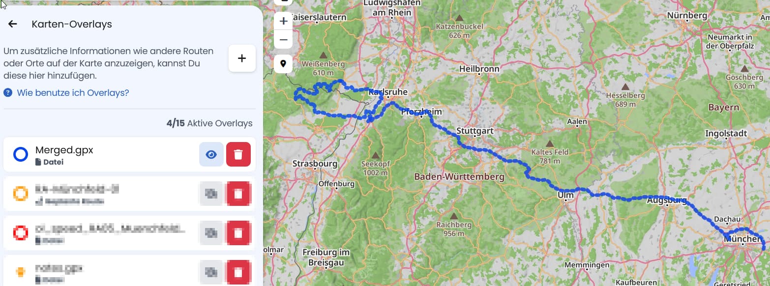
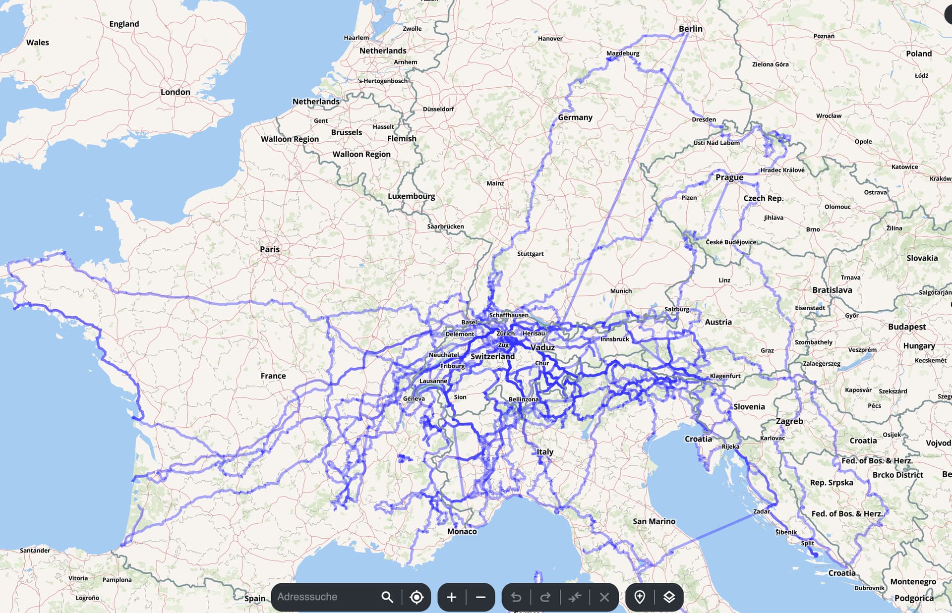
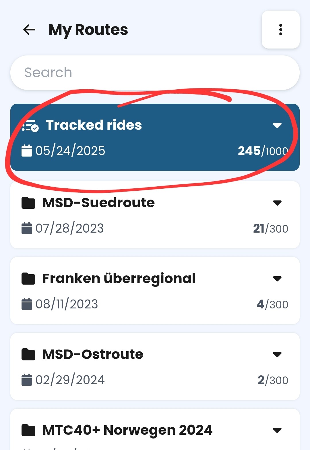
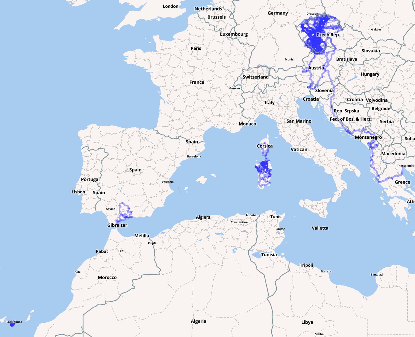
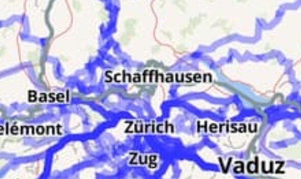
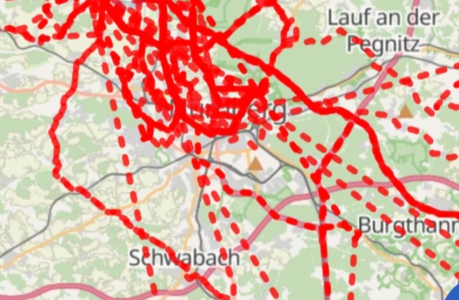
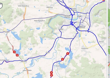
As someone who came from Calimoto as well, I don’t see it the same way. Calimoto has no concept of folders and you cannot create custom overlays. You have a one giant pile of rides, that you cannot distinguish from each other. So in that sence it behaves like Kurviger’s “Tracked rides”. But at least if you click on one of the lines, Calimoto will show you the entire ride corresponding to it. Kurviger does not do that, unfortunatelly. I wonder, what will happen when I reach the “1000” Tracked rides limit? I’m concerned about that. These rides are like a memory for me and work like a gamification of the ride. I want to make more places on the map “blue”. I also think, the visual representations of these rides is better in Calimoto (in Kurviger it competes with the other folder overlays - if the route is saved in a folder, viewed as an overlay and also I have tracked route through it, I can barelly see the folder overlay color. Also I would prefer solid lines, instead of dashes).

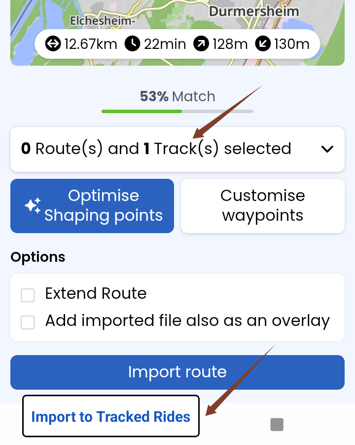
I’m very sad, there is no way to import en masse files from calimoto to the tracked folder. Not even one by one. As I said, it’s like a memory to me of all the adventures I had. It’s one of the few reasons I’m keeping Calimoto around.

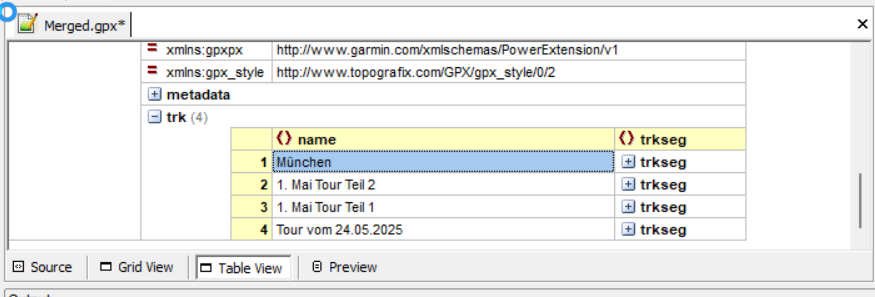
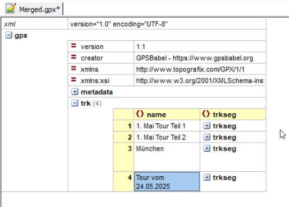
But on the other side, Kurviger adds the entire concept of the folders and additional routes, that you can add as an overlay. You can create entire routes and add them to a folder and display them on a map. So no longer a big pile. That’s why I’m here. I’ve got tired of waiting on Calimoto to add any useful features.

Perhaps I use Kurviger differently, than it was designed to be. But I distinguish 3 different concepts, even if in the end it’s the same thing - a line on the map. These are:

  1. Tracked rides
    As I said, these are the memories and I would love for a way to transfer them from Calimoto to Kurviger. These are actual rides, that I have completed. And I want to see them all on the map at the same time (with the option to hide them temporarily).

  2. Good roads
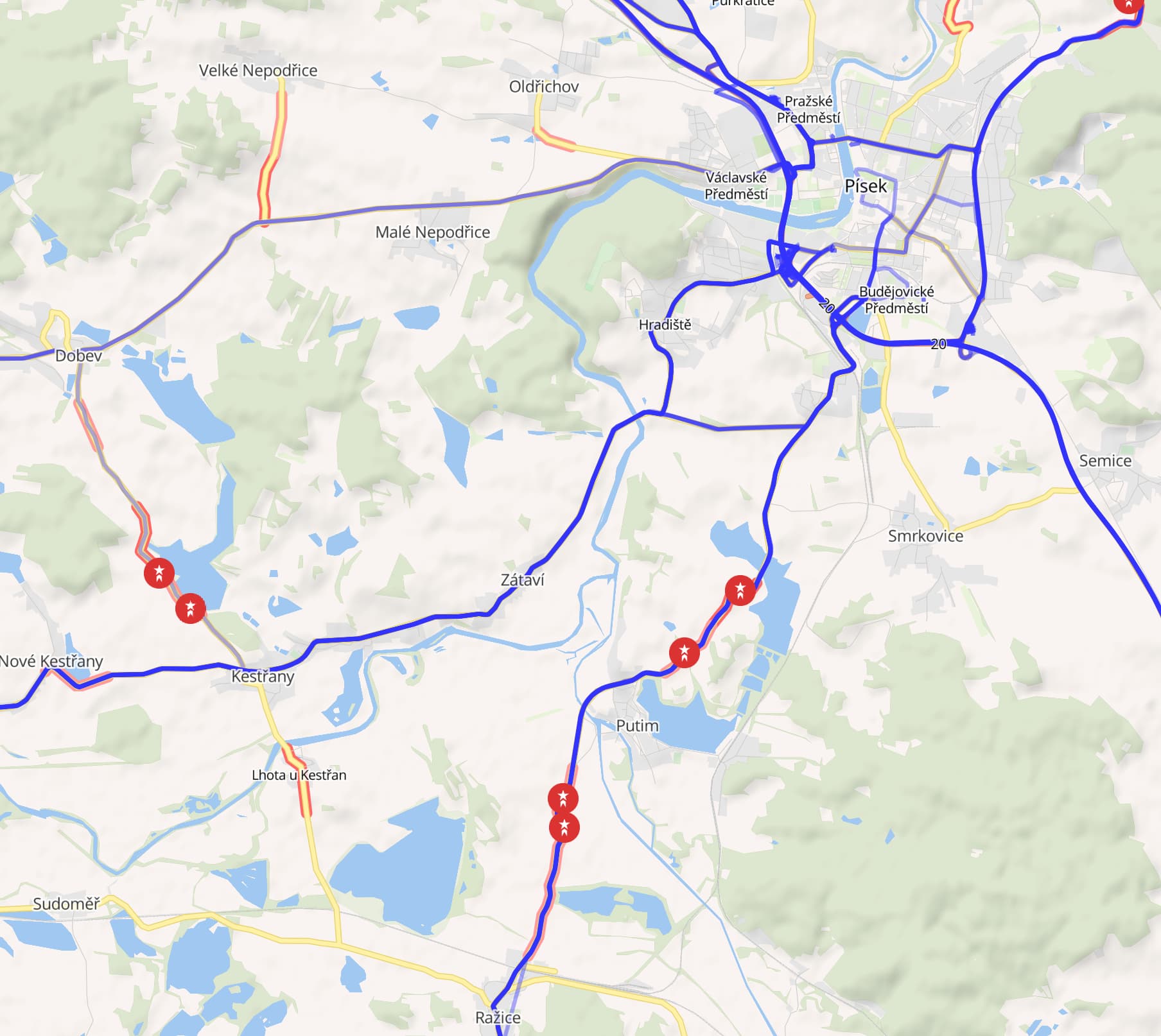
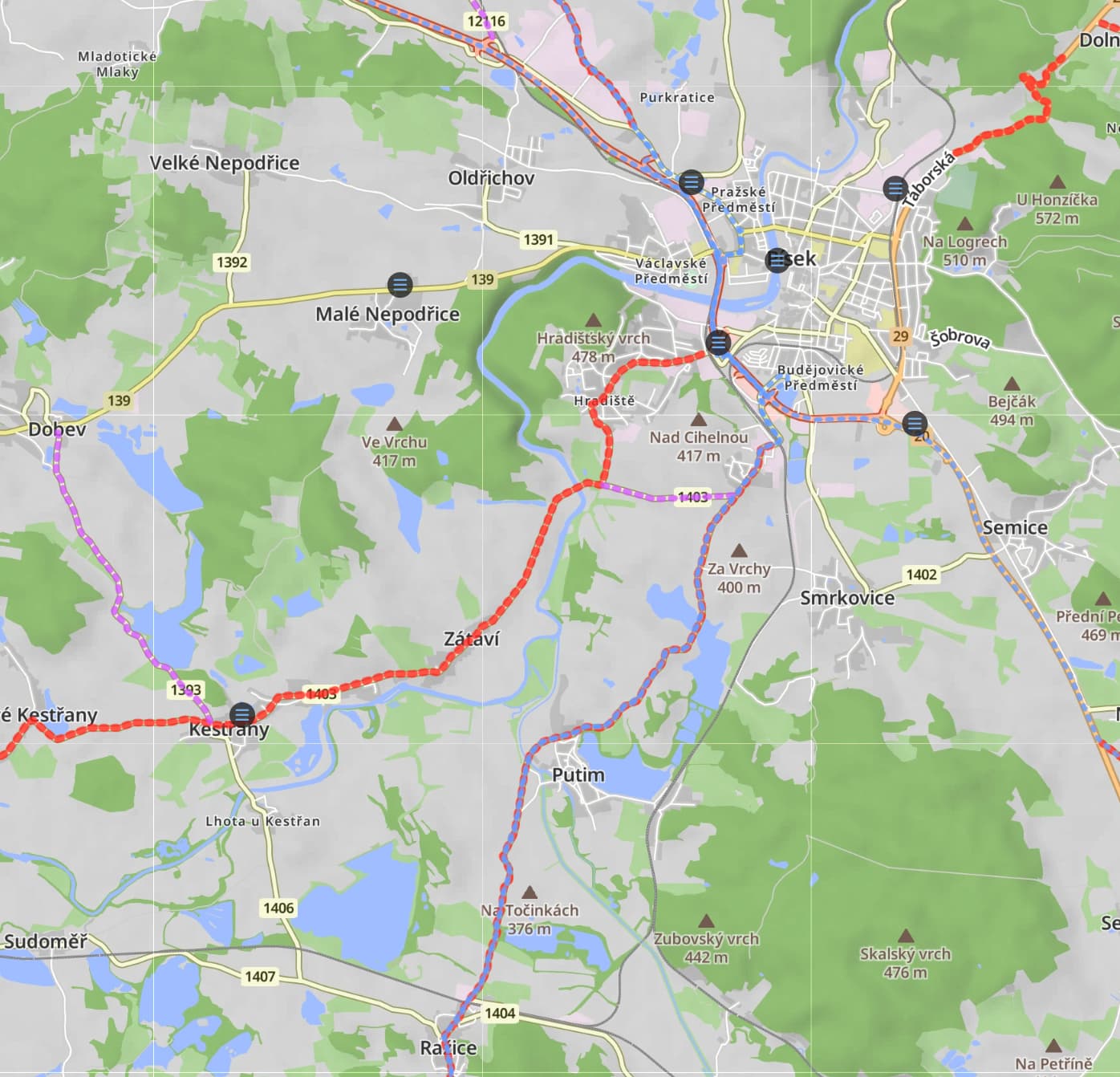
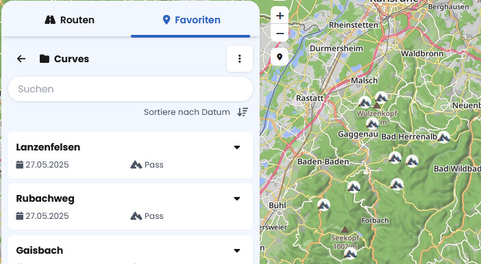
    These are the per country folders, that contain marked route sections that I’ve ridden and liked. Or somebody recommended to me to ride in the future. Or I’ve researched to be good. It may contain only a part of the single road. Or just one corner. I’m fine with enabling only the select few countries (folders), that I’m currently interrested in. But I want to be able to see several entire folders on screen together with tracked rides. That’s what Kurviger already does. I would just like for these to be seen on top of the tracked rides, not behind, if it’s the same road. But the main thing is, I will never load these to Kurviger to use to navigate by. They’re a guidance for planning a route, not the actual route I will ride.

  3. Actual planned routes
    These are what I presume Kurviger originally envisioned when creating the folder concept. These are the actual “On day one, I will start here, go via this, arrive there”. I have one single folder for “Planned routes”, since I don’t expect to want to ride the exact same route twice. I actually delete these after I ride them. But if I were a tour guide, I wouldn’t and I would propably have a folder for each “tour”, with exact routes for day 1, 2, 3… etc. But I wouldn’t expect to be able to see all 50 tours (ie folders) at once.

Kurviger doesn’t distinguish technically between 2 and 3, but they should know, some people like me might.

So my wish list for Kurviger in this would be:

  • Unlimited number of tracked rides, all seen on map at the same time (like Calimoto does).
  • Ability to mass import rides to tracked rides, ideally even directly from Calimoto
  • Ability to set order of importance for overlays, so that some can be on top of others
  • Ability to change dashed lines to solid lines for both folders and tracked lines.
  • Ability to click on the tracked road or other overlayed route and see the detail (like Calimoto does).

If this would be implemented, together with sharing entire folders, live tracking, live traffic, creating one-click road highlights during rides, notifications for approaching selected POIs and I would be in a heaven :slight_smile:

I have a kilometer long list of other ideas, but these are the main ones.

2 Likes

Nearly the same here: I want to save my rides and compare them to the ones in the future, also on the road!

And yes, the management by self created folders is one of the main reason for my change from Calimoto to Kurviger too (and the algrorithm).

In my opinion, I’m missing this things for an perfect experience (nearly the same as User SmurfyPanda):

  1. possibility to move rider tracks in self created folders - an absolutely MUST, I dont’ see the reason why this is possible for planned, but not for driven routes.
  2. Unlimited obverlays - or at least unlimited regarding to the numbers of folders
  3. Tracks not to be displayed als dashed lines put as normal lines
  4. Possibility of showing all Overlays (tracked rides) on one card (example of Calimoto attached) as an overview of all the rides ever done :slight_smile:

That’s it for the moment. At Calimoto I’ve payed over 50 Euros each year. So at least for me it’s not a matter of money, but of a powerful motorcycling navi app, which I will use for a lifetime!

Thank you!

2 Likes

You can still continue tracking your rides, but please let us know when you reach 950 or so, we can increase this limit.

Can you clarify on that? You can change the width and color of each overlay to fit your needs, dashed vs. solid line is something we have on our list in the future.

Ok, so that is available via Overlays as well, you need to create your own GPX right now though.

We do have that concept in mind and I agree that right now we could further improve this :+1:.

The thing is, even now, you can clutter the map into a state where the map in a way that everything is becoming very slow. You can actually add an insane amount of data with these 15 overlays. That’s the problem with GPX, that’s why we had to limit it to some reasonable number. We should however make it easier to merge multiple GPX files into a single overlay.

Ah ok that makes sense, we can see if we can add this to Kurviger :slight_smile:.

1 Like

I think, one qualitative difference is that Cali uses transparency (i.e., opacity), which has two effects:

  1. You are able to see which sections you ride more often then the others (when two tracks overlap, the line becomes darker) and more importantly…
  2. You are still able to see the map below it (especially the city names at larger zoom). Here is a comparison Calimoto vs Kurviger

If you could also add transparency and allow the map below the overlay to be better visible, that would be great. Also the city names above the overlays would improve the visual orientation.

and

and

I ask myself if uploading gpx to “Tracked Rides” is a valid usecase - and perhaps less effort and more intuitive.

Seems to be an important point for those, who change to Kurviger.

Uploading gpx - even just to Tracked Rides - as single files or zipped file feels to me quite intuitive. Handling Overlays requires already enhanced knowledge.

So something in the sense of a migration tool. Migrate and drive.

Edit,
Perhaps in the Import dialogue.
If only one track is selected, then a button to import to Tracked Rides is offered (optional :only tracks are selected and count of tracks plus already recorded < max. Tracks). If the file contains no name, it should be an error, i guess.

So I tried to create screenshots of the same area in both Calimoto and Kurviger. As @t00thl355 said, Calimoto uses transparency. More blue the road is, more times I’ve rode on it (and if you zoom in enough, it splits into individual rides, that you can click on). And also as he nicely noticed, they show town names on top of overlays.

Kurviger has the entire concept of overlays, which is awesome and as I said, one of the main reasons I was moved to switch.

But it creates a challenge. See the map. The light blue are tracked rides. Red ones are “good roads” (rudamentary attempt in Cali are the highlight points).

You can see the southbound road around a village “Putim”. It is both. So “good road” and tracked. But I can barely see the red color. And the red has set the thickest line, blue has about 75%. And if I make it thinner, it will be hard to see when zoomed out.

I would like to tell Kuviger to show red on top of blue. With combination of adding possible transparency and switching tracked or some other folders from dashed to solid lines individually, it could improve the readability.

1 Like

Doesn’t it just mean, that your home area is darker?
I also had C. some years ago. I could not see an advantage. I know my home area, the interesting parts are the others.


Nice roads .. do not understand, if these are marked parts as proposals from Calimoto or you marked it somehow?

My nice routes with nice roads would be in my folder “Nice Routes”. I use rather my “Nice Routes” as Overlay than the driven tracks, when I want to drive it again.

To be honest, I do not understand this concentration on tracks. I see, where I already drove, then decision to avoid or use it. And then I activate the overlay just for this single track or route. After planning, Overlay visibilty off.


You describe the special case “two overlays”. You can have up to 15.

I work a lot with overlays, I just switch visibilty on and off with one or two clicks. No fiddling with special custom color, with or without transparency, or width. Too much work. :grin:


I support closed lines against dashes, or names above overlay. The things above, why not, but for me no game changer.


Just a note. You see the activated overlays also in navigation. This could slow down your phone or increase battery usage. I switch off all overlays, and only activate what I really need fir navigation, like “Current Route”.

1 Like

@SmurfyPanda: Danke!

Nachdem ich gestern ziemlich kritisch war, habe ich nach etwas anderes gesucht. Zumindest mal für diese Markierungen schöner Stellen. So banal, ich habe mich geärgert.

Ich habe mir einen Favoritenorder “Curves” erstellt, dann bin in meiner Gegend durch dir Karte und habe schöne Stellen einfach als Favorit erstellt, Kategorie “Pass”, es fehlt an mehr Symbolen!

FĂĽr die Route musste ich dann nur den Favoriten entlang klicken.

Also anders gesagt: Vielleicht kannst Du auf die doppelten Overlays der Tracks verzichten, alle Tracks in ein Overlay. Die schönen Stellen werden zu Favoriten?


Ich habe in Favoriten zu dem Ordner “Curves” die Kategorie “Kurviger” vermisst. Zum Beipiel so. Ok, viel Mühe habe ich mir nicht gegeben.

grafik

2 Likes