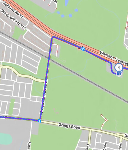
When you get the turn instructions that turn into Troups Road North doesn’t get a mention
Gas Station
78m (30.02km) 0min (41min)
Keep right
120m (30.14km) 0min (41min)
Turn left
662m (30.8km) 1min (42min)
Keep left
1.24km (32.05km) 2min (44min)
Turn right onto Greigs Road
4.89km (36.93km) 4min (48min)
Troups Road North is not mentioned, and the next turn is the turn from Troups Road North into Griegs Road. I’m guessing it doesn’t think I’m going back onto the freeway or something about Troups Road North in terms of its status.
[EN]
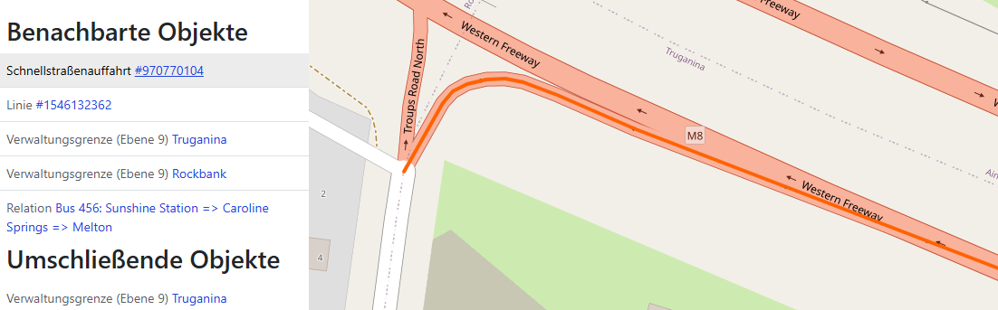
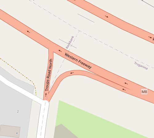
I suspect this is because the route initially takes you onto the motorway exit (turn left), and this exit doesn’t have a name. According to OSM, it runs as far as Troups Road North, as the image shows: (red line)
At the end of the red line, you don’t need to turn any more; you simply carry on straight ahead onto Troups Road. A prompt such as ‘Turn onto Troups Road’ is unnecessary.
But perhaps I’m wrong about the reason.
[DE]
Ich vermute, dass es daran liegt, dass das Routing dich zunächst auf die Schnellstraßenabfahrt führt (turn left), diese Abfahrt hat keinen Namen. Diese reicht laut OSM bis zur Troups Road North, wie das Bild zeigt:(rote Linie)
Am Ende der roten Linie musst du nicht mehr abbiegen, du fährst quasi geradeaus in die Troups Road. Eine Hinweis wie “Abbiegen in die Troups Road” ist unnötig.
Aber vielleicht irre ich mich auch mit der Begründung.
It is that BP Rockbank that I have a waypoint at - you then join back on the freeway before taking the exit to Troups Road North. If I set the waypoint further away from the exit it doesn’t change the directions, Troups Road North will still not be shown.
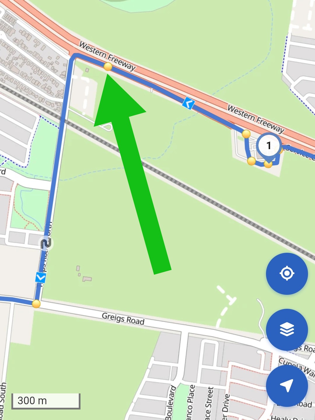
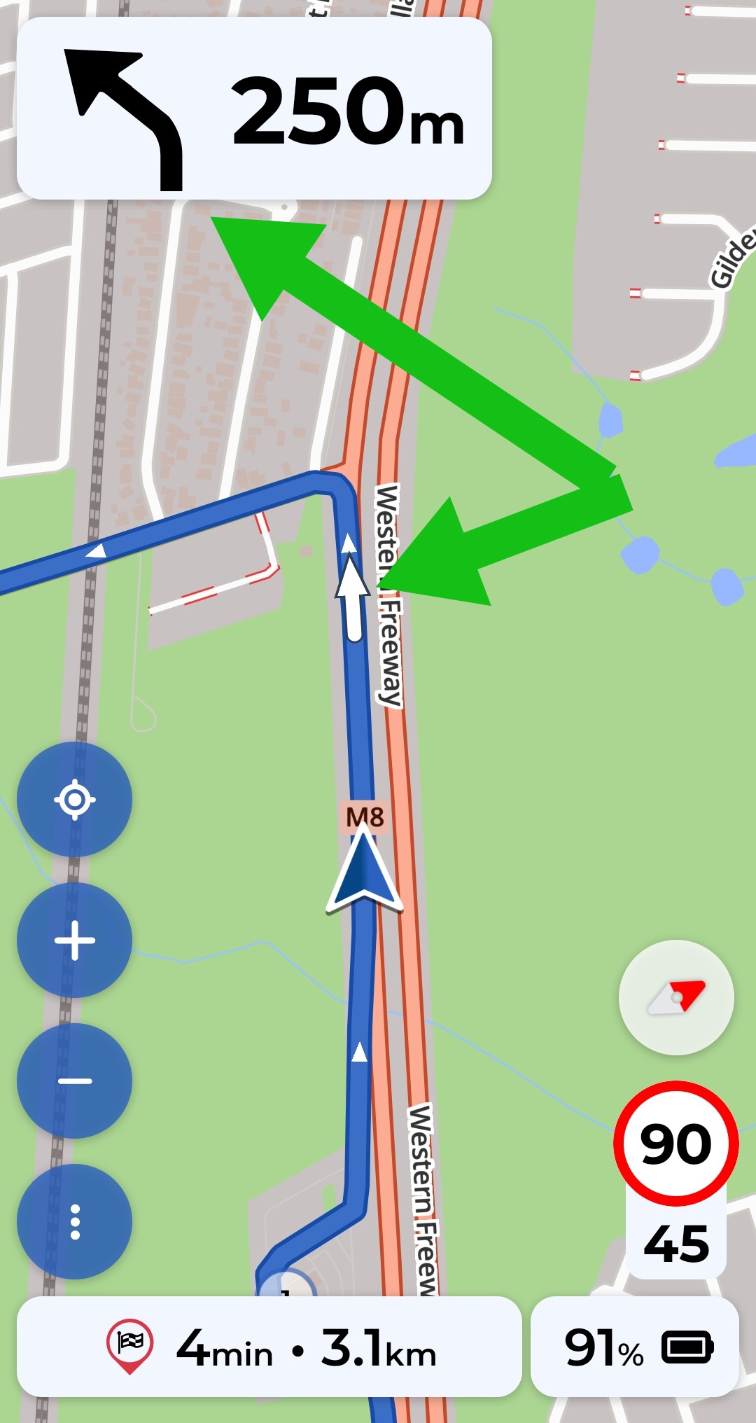
The yellow dots are marking the position where the turn instructions will be announced. The arrow on the map is showing the “turn left” instruction. It is the place where you really have to commit to the right lane to be able to turn left.
The white arrow on the route looks almost like going straight because the two roads fork at very small angle, but the arrow in the info box (upper left corner) clearly shows to turn/keep left. After that node (fork), the next node/crossroad is with Ballarat Road Service Road and Troups Road North. In this node, as @Maxx18 mentioned, you continue straight to the Troups Road North and Kurviger does not give any further instructions on that node.
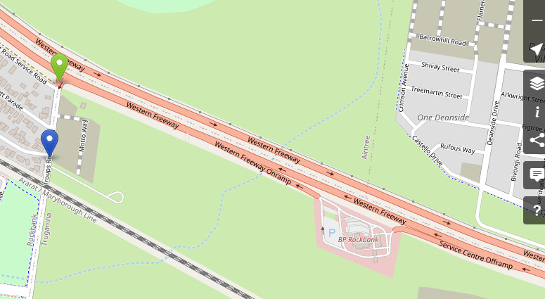
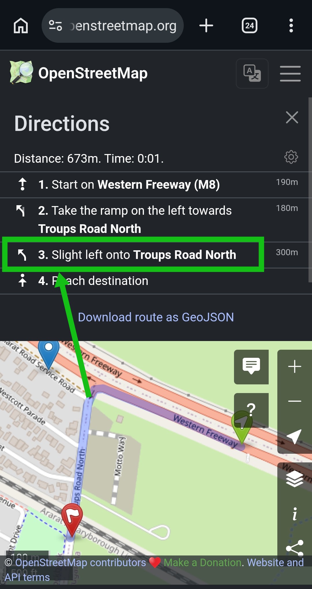
In contrast to Kurviger, OSM will issue a “slight left” instruction on this node, which is probably just a different interpretation when a line is a “straight” and when it is a “slight turn”:
The bottom line is - Kurviger likely behaves as designed for the given OSM data. It gives a very brief turn instructions, which we may or may not like. I sometimes wish I get an extra instruction but am also silently grateful that my music is not constantly interrupted by unnecessary announcements.
I doubt it is interested in my music listening pleasure. This issue came up when looking at turn instructions on the web interface - I was planning to export for a road book for a club ride. That Troups Road North turn never gets announced even if you remove the waypoint at the BP station. I suspect it thinks it is the Western Highway or it just doesn’t have a name and that’s why it doesn’t announce it. From OSM
It is Australia so I’m on the left hand side of the road so that’s a left turn coming off the freeway onto Troups Road North. I’m not familiar enough with OSM but I’m suspecting that may be the issue - the exit of the Freeway to Troups Road isn’t named so it just says “keep left”.
I’ll add, it is probably the worst freeway connection in Melbourne. There really isn’t anything like a real freeway entry or exit ramp there as such, just a side road with a traffic island connecting to a major freeway.