Ich frage für einen Freund (jaja - kennen wir aus der BRAVO), der eine Oldtimer-Gruppe hin und wieder anführt.
Die Teilnehmer wollen, wenn überhaupt, nur mit GMaps navigieren (Bei denen sind nicht nur die Autos alt!). In GMaps ist die Anzahl der Wegpunkte auf 10 begrenzt (Start/Ziel + 8 Zwischenziele). Also (einfache) Route in GMaps kreiert, den Link erstellt und an alle Mitfahrer per WhatsApp bzw. eMAIL versandt. Funktioniert insoweit.
Jetzt die Frage: Sind damit die Möglichkeiten ausgeschöpft oder gibt es bessere Verfahren?
Mein Freund könnte sich durchaus für die Planung mit Kurviger begeistern, aber KML-Export hin oder her, GMaps importiert das nicht - oder? Und MyMaps habe ich noch nicht benutzt.
Vielleicht hat sich ja jemand schon mal mit dem Thema GMaps näher befasst …
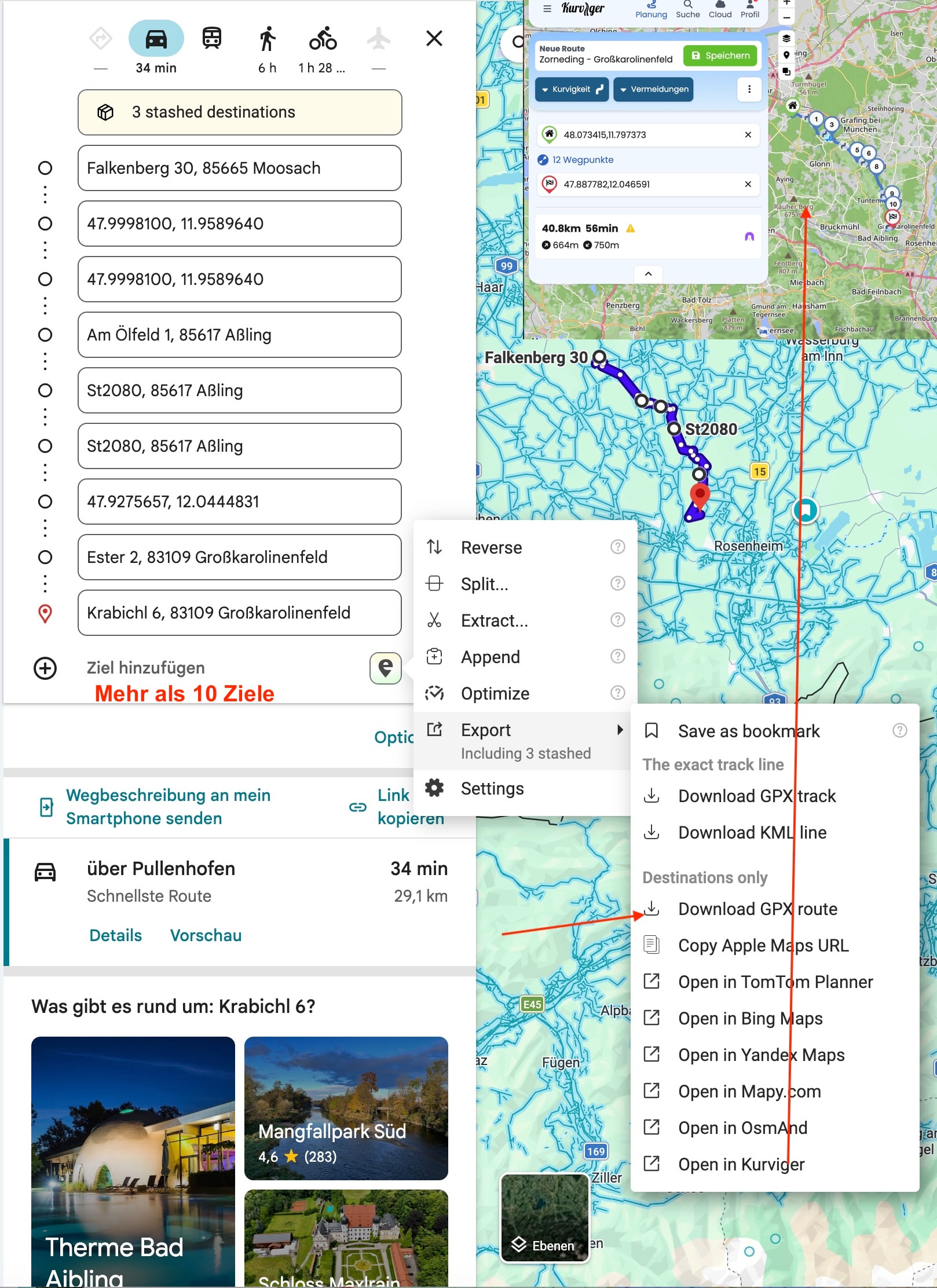
I’m asking on behalf of a friend who occasionally leads a classic car group.
The participants only want to navigate using Google Maps, if at all (it’s not just the cars that are old!). In Google Maps, the number of waypoints is limited to 10 (start/destination + 8 waypoints). So, he creates a (simple) route in Google Maps, generates the link, and sends it to all passengers via WhatsApp or email. It works to that extent.
Now the question: Are we out of options here, or are there better methods?
My friend would definitely be interested in planning with Kurviger, but KML export or not, Google Maps doesn’t import that—does it? And I haven’t used MyMaps yet.
Maybe someone has already looked into this Google Maps issue in more detail…