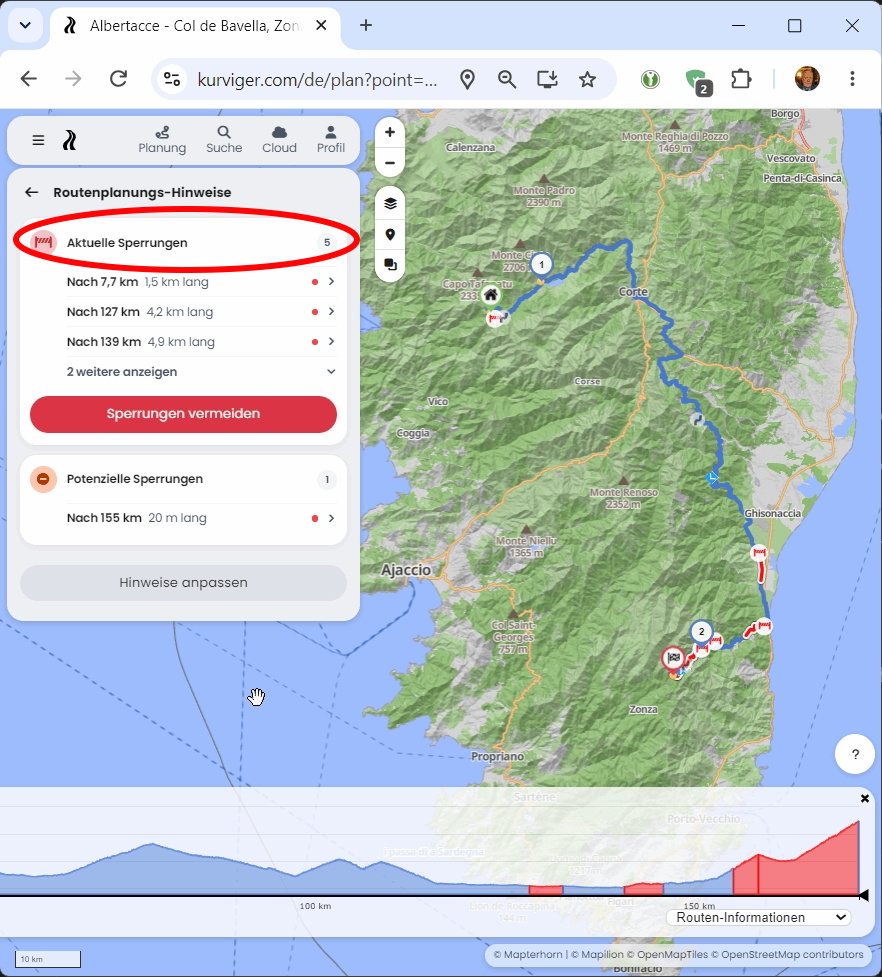
When planning my trip to Corsica/Sardinia, continuing further is not possible in several places.
From Col de Vergio on the D84 towards Albertacce — the route suddenly redirects to a different path.
From Col de Bavella on the D268 towards Col de Larone, the same thing happens.
In Sardinia, at the end of the SP66 from Portu Maga heading south, there is a ford, after which the SP66 continues towards Ingurtosu.
On all 3 roads, I was able to plan the route using Google Maps without any issues.
There are some current closures in Corsica that might be irrelevant to your planning. With these settings, you can continue planning in peace (left) while also checking the individual closures in detail (right). If you select “Route Information” in the elevation profile, the corresponding spots will also be shown to you (right):
- - -
Try it out here:
https://kurv.gr/6WM8d
In Sardinia, as far as I know, everything is still fine: https://kurv.gr/9hEsA
We know each other from the Munich Bikers - right?