Good morning,
I use the maps to create off-road routes and it turns out that whatever map is used, the paths are absolutely not up to date. As a result I have to put a lot of tags linked together by a line (as the crow flies) which after about 500 tags gives me the right to an error message and prevents me from continuing. I use the OSMAND application on my phone and on their maps these paths are there. Could you make the OSMAND cards which are OSM cards available on your application so that I can work?
Hello, Kurviger is not an offroad navigation device. Could you please show some examples where data is missing?
I can’t quite share this experience. We recently rode the ACT Portugal and were able to plan the tour with Kurviger using the tracks provided. Over the entire distance of ~1200 km we needed maybe a dozen “beelines” but many shaping points to force the route.
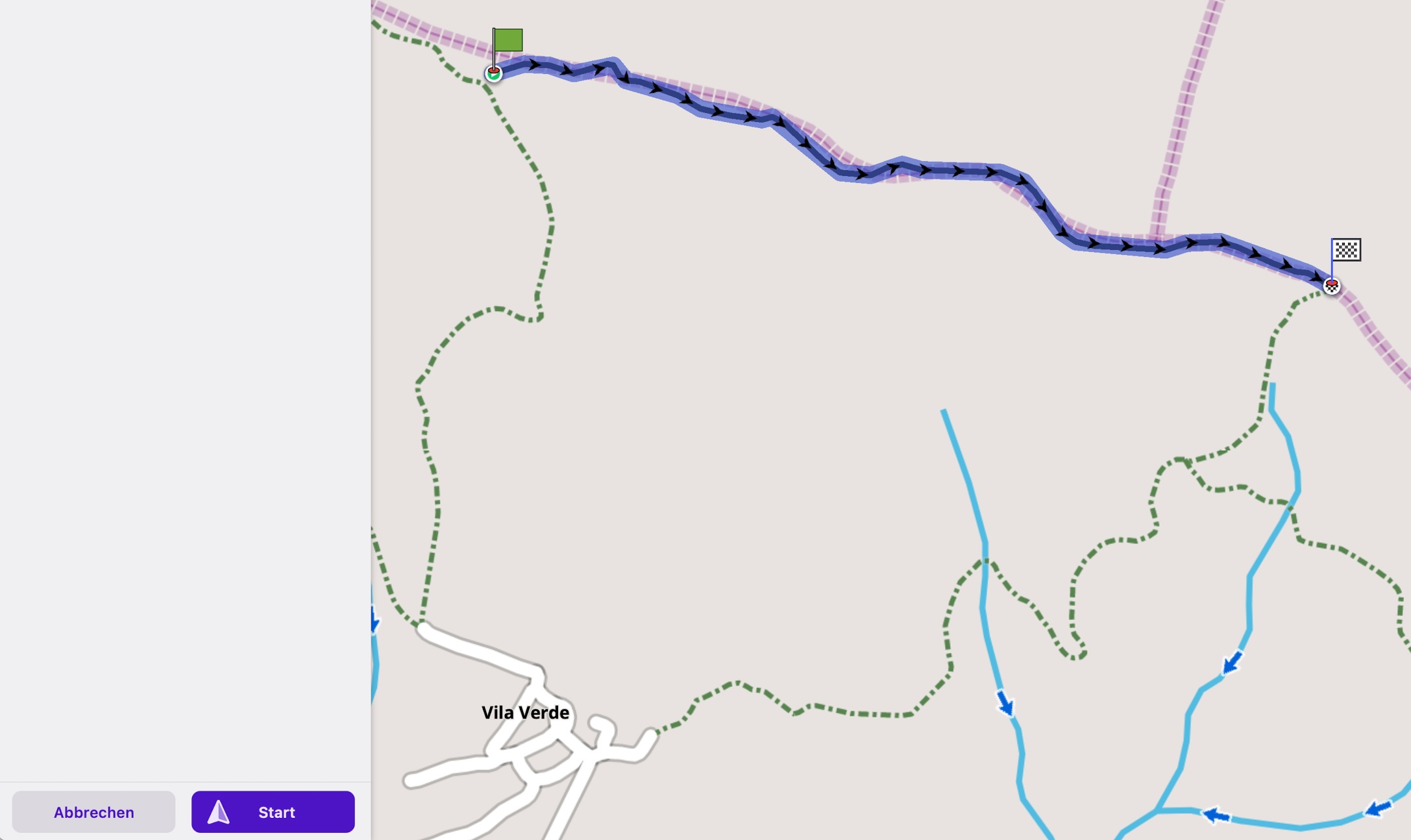
Here is an example from our current planning - a loop in the Pyrenees that has already been ridden by motorcycles. The routes between (5) and (7) are not routed because motorvehicle=no and highway=path is defined in OSM (for 7 years already). You can perhaps ignore this - but Kurviger does not, and that’s okay.
When we have driven there next year, perhaps I can correct it in the OSM.
1 Like
I wanted to send you a gpx file as you asked me but I got this error message:
Sorry, new users can not upload attachments.
The differences are mainly at the track level between Google Earth and the OSM maps. Many tracks are on Google Earth and not necessarily on maps. Even if Kurviger is not an off-road software, is there a way to obtain more up-to-date maps for these tracks?
Your account has been changed and you are now allowed to upload files.
Please remember that it is easier for the users in the forum if you share a Kurviger link instead of uploading a gpx.
OK, I didn’t know, here it is.
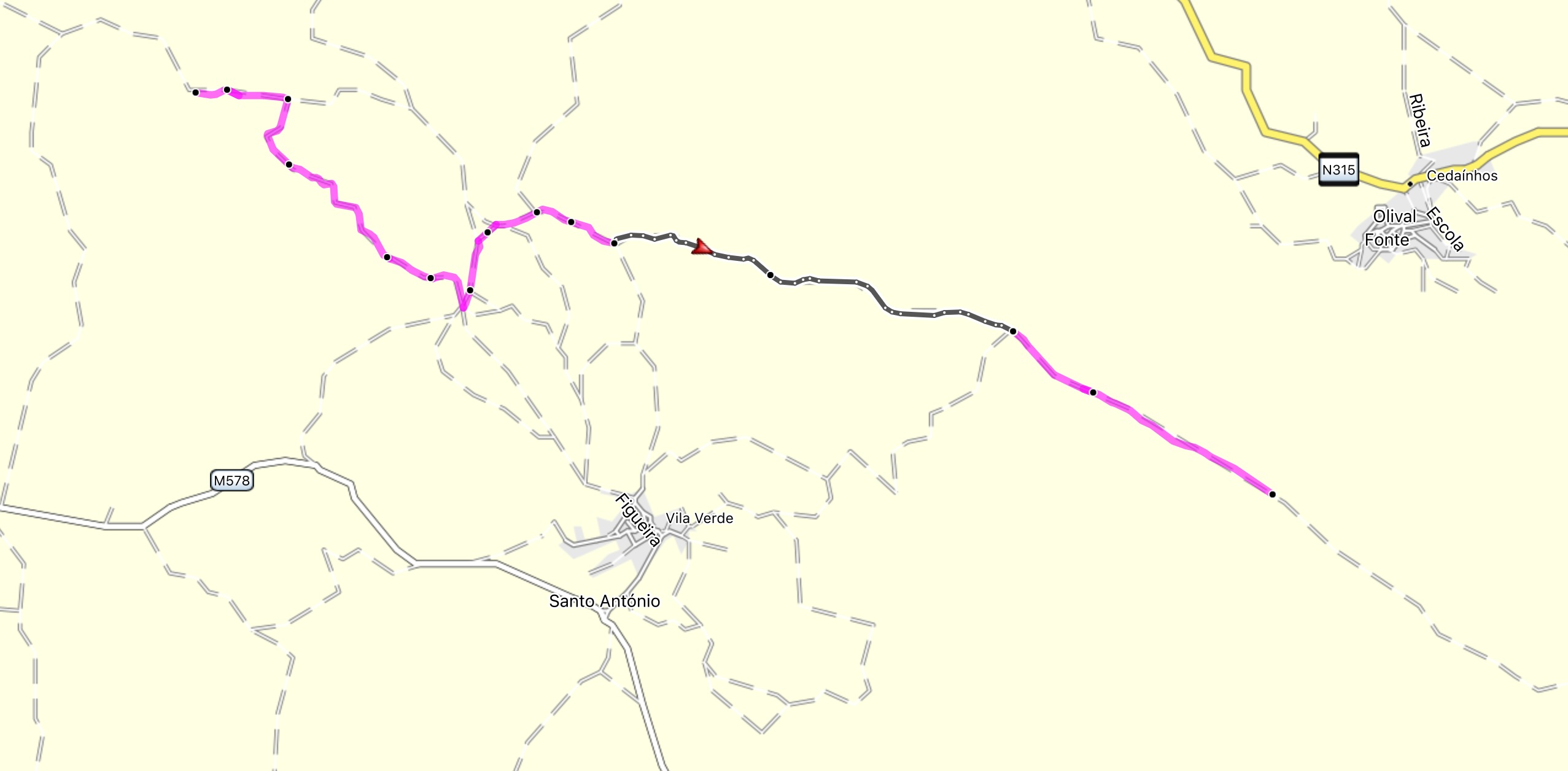
This route:
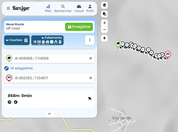
is not defined here in OSM, so BaseCamp and OsmAnd use other sources … I don’t look at either.