Hi all,
let me take this opportunity and show you the (quite precise and large) route that I did with three friends the for the last two and a half weeks.
Kurviger URL: https://kurv.gr/FPewa (Beware >140 waypoints, takes quite some time to load)
Total distance on the island alone: ~2400km
Total distance including motorway to and from ferry Hamburg ↔ Amsterdam: ~3500km
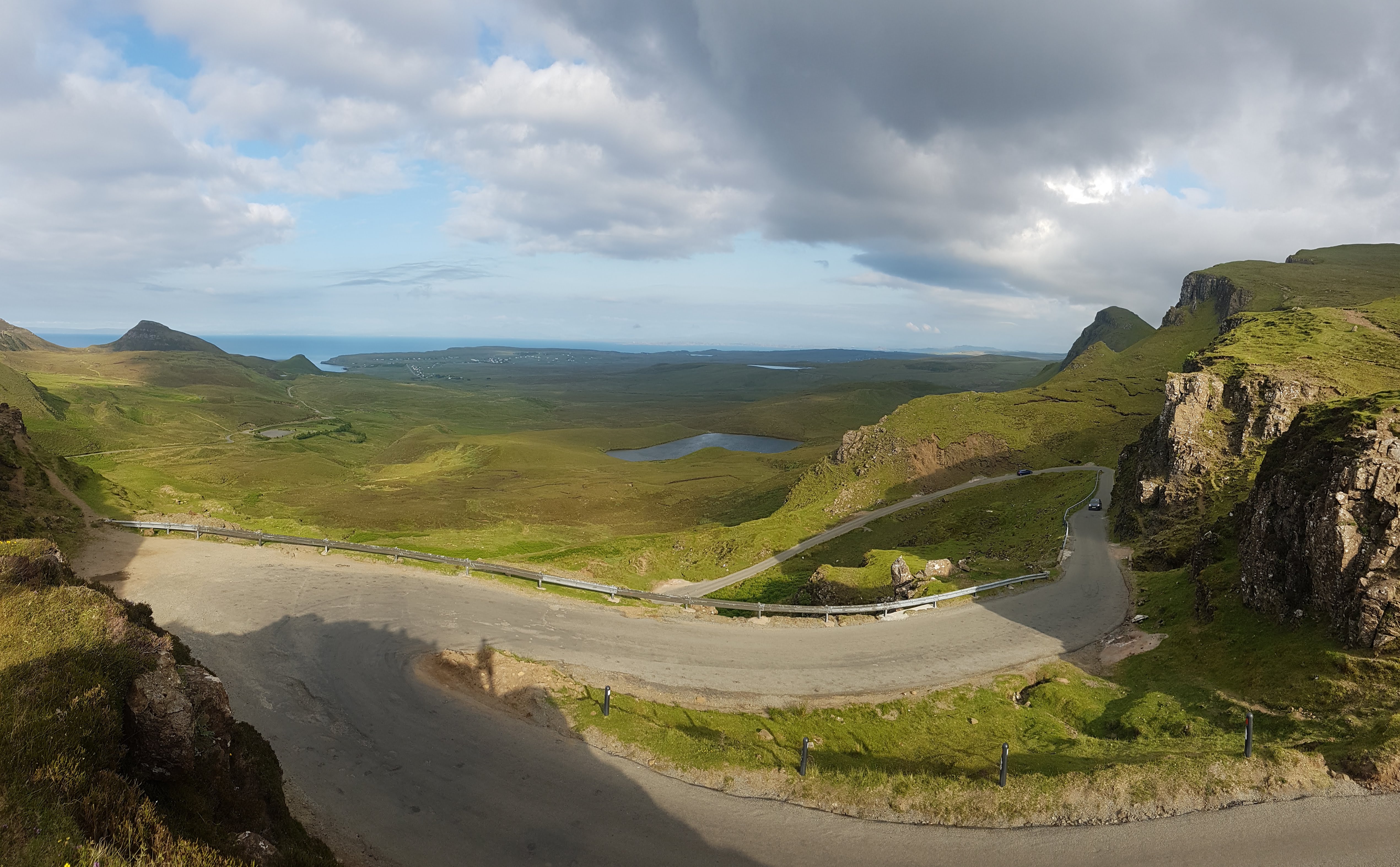
Maybe this can help some of you when planning your vacation. I cannot stress the beauty of the Quiraing (Marker 44) and the Applecross pass (en route to Marker 51) enough. These two as well as The Lecht (Marker 65) and Glenshee (Marker 73) do really feel like a minor Alpes pass, that sense of climbing and pressing into the corners and viewing across an area of other mountains really comes back to you - not something I expected from Scotland.
Let me also mention that this trip wouldn’t have been as successful as it was without Kurviger, thanks guys! My way of planning is:
- Check a lot of route elements weeks or months in advance. Use the curvy and super curvy modes (with offroad turned off)
- Double check all small roads and some of the others on Google Streetview. The coverage is really excellent and you might be able to weed out some offroad that Kurviger wasn’t able to filter because of OSM
- On the day of driving keep Kurviger on as a backup and use the GPX track on a real Satnav if available
- If you sleep or drive somewhere else than you thought just ask for wifi or go outside to get some signal (thaaaaanks EU roaming yeah!) and turn on Kurviger again. If you know already more or less where you’re going set some markers and use the “fast and curvy mode” so that the diversions are not too extreme and go off the path you’re already a bit familiar with
This procedure might be a bit different in other countries with other street quality (or OSM quality) but for Sctoland I would really recommend a ton of research with Streetview
I’ll be in the comments below if you have any questions. Cheers