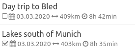
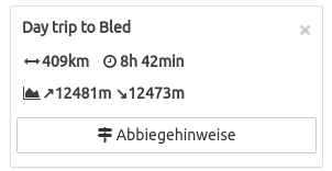
Ihr seid die geilsten! Super Feature!
Wird sogleich für die Planung der Lofoten-Tour genutzt.
Und da fallen mir auch gleich noch ein paar kleine Features ein:
Export aller Routen / Tracks eines Ordners, wahlweise als eine .gpx Datei mit mehreren Tracks oder auch als zip mit einzelnen .gpx files
Alle Routen eines Ordners auf einmal anzeigen (also Overlay)
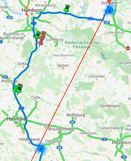
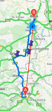
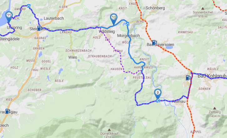
This the route you saved. The blue line is the one that was calculated by Kurviger. This can be useful for two things:
Compare the for example when changing route settings, adding waypoints, etc.
When loading the route after some time it might differ because the road data might have changed, that way you can see how the route looked like initially and can change it if needed.
Interessante Ideen, da hab ich noch gar nicht drüber nachgedacht. .
Great feature and an important step for the Kurviger website! I really, really like it!
I already took a “deep dive” into the new functionality (imported/migrated more than 150 routes from my personal library) and here are some suggestions that could make things even better:
sort function for collection entries (name, distance, date, estimated time)
search/filter function (to get all route from your collection which contain a certain substring in their name)
prevent the deletion of a collection which still contains routes
display how many routes are actually stored in a collection
after selecting a route from a colletion: always display the name of the route and the collection from where it was loaded (important to keep things clear if managing your routes and moving them from one collection to another or make copies/clones)
Erstmal vielen Dank für die tolle neue Funktion. Ein weiterer Vorschlag von mir, falls nicht schon erwähnt, wäre die Möglichkeit Ordner zum stöbern frei zugeben, zB über einen Link etc.
First of all, thank you for the great new feature. Another suggestion from me, if not already mentioned, would be to allow the possibility to share folders for browsing, e.g. via a link etc.
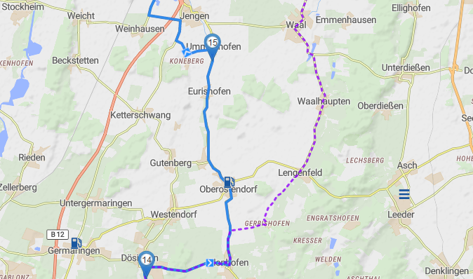
After having done some more tests with the new collection functions I have to state that I really like the fact that after loading a route from a collection it keeps displaying the original route with a dotted magenta line if you modify your route ( very helpful ):
But sometimes I additionally want to compare two routes to be able to decide which one to choose or to create a new route which is somehow a mix from both.
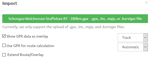
Here’s my current workflow to do this:
Select the first of the two routes to be compared from your collection.
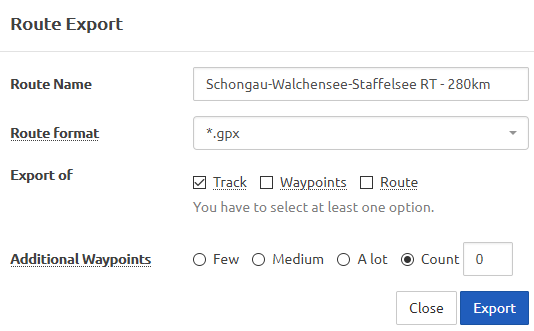
Export this route as a track using the following options:
Useful if not necessarily a very fast approach. Maybe we’ll see some more comfortable functions for a comparison between routes in a future enhancement of the new collection functions.
Or maybe someone has a good hint for me how to do this better / more quickly.
These are very good hints,thank you @SchlesiM. I had some of these already on my mind. I really like the option to forbid the deletion if there are still routes in a route folder.
Thanks for the suggestion, that’s a nice idea. I had something like this on my mind as well, but I guess this will take a bit more time to implement, as this is a bigger feature.
Currently, you would have to do this with the gpx overlay feature. We could keep all the overlays from previously loaded routes, but this lead to a “pollution of overlays”. Maybe there could be an alternative to show multiple overlays of selected routes.
Geht es, das alle gespeicherten Routen angezeigt werden, und ich durch einen Auswahl-Button die Sichtbarkeit auswählen kann?
Und da wir gerade beim Personalisieren sind, hätte ich gern noch zwei Eckdaten gespeichert.
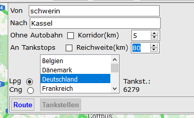
Tankreichweite: So kann ich schnell erkennen ab wo ich einen Tankstopp einlegen muss.
Tagestourenlänge: So habe ich eine Übersicht, wieviel Tage ich für meine Tour benötige und erleichtert mir doch die Planung bei Mehrtagestouren sehr.
Und bei einer Routenänderung würden sich die zwei Punkt gleich mit anpassen.
Ich gebe es ehrliche zu, was ich suche ist die Eierlegende-Woll-Milch-Sau (DeepL Übersetzung: egg-laying wool milksau) der Navigation . Dies Wünsche wären von meiner Seite ein Schritt in diese Richtung
Das kommt im Zuge des “Favoriten Features” . Ich hoffe mal, dass braucht nicht mehr so lange
Hast du mal probiert, das über das Erhöhungsdiagramm Rechts-Unten zu lösen? Da kann man recht gut sehen, wie weit die Route an einer Position ist.
Ja es ist wirklich schwierig alles unterzubringen. Ich behalte das mal im Hinterkopf, vielleicht passt es ja mal, aber ich glaube das führt eventuell doch etwas zu weit
Ich habe mir jetzt Ordner angelegt “Geplante Routen” und “Gefahrene Routen”. Meine Frage dazu wäre, wie bekomme ich eine Route direkt von “Geplant” zu “Gefahren”? Ich finde keine Möglichkeit den Ordner zuändern!?
I have now created folders “Planned routes” and “Hazardous routes”. My question would be, how do I get a route directly from “Planned” to “Danger”? I can’t find a way to change the folder.
Also eigentlich war die Idee, dass man den Haken bei gefahren setzt und dann nach gefahrenen und nicht gefahrenen Routen filtern kann . Filtern ist noch nicht eingebaut
Verschieben in einen anderen Ordner ist aktuell noch nicht 1:1 möglich. Ich bin gerade dabei, Stück für Stück die fehlenden Funktion nachzureichen. Aktuell müsste man die Route öffnen, in den anderen Order gehen, dort als neue Route speichern und dann die alte Löschen. Das übernimmt aber nicht die Beschreibungen etc. daher ist das vorerst als Notlösung zu betrachten.
Ja das habe ich schon Probiert. Es ist ein Ansatz. Nur leider muss ich nach jeder Routenänderung erst im Erhöhungsprog. nachschauen und dann die Stelle wieder auf der Karte suche. Da Kurviger nun mal die kleinen interessanten Straßen bevorzug, kann es sogar in Deutschland eng werden mit dem Sprit. Also ich würde mich freuen, wenn ihr dies Option Tankreichweite mit aufnehmen könntet.
Na das ist doch schon mal ein Anfang. Ich habe zur Zeit 4 Navi-Apps auf dem Handy. Und jeder möchte sein eigenes Kartenmaterial. Deswegen mein Wunsch nach etwas Großem
Und wie heißt es immer so schön: “Ihr wachst mit eueren Aufgaben!”
In diesem Sinne, macht weiter so
Viele Grüße
die Reichweite sollte schon jeder selber bestimmen können. Wann schafft du 190 km und wann 250 km? Das kannst du ja dann in deiner Route berücksichtigen. Eine Reichweite von 300 km habe ich bis jetzt immer geschafft. Nur halt einmal mit Reserve und ein anderes Mal ohne Reserve.
Und hier wäre diese Einstellung für meine Routenplanung eine absolute Hilfe. Jetzt müsste ich solange meine Route ändern, bis sie für mich fahrbar ist. Weil ohne Benzin ist diese Route nun mal nicht durchführbar.
Bitte jetzt nicht daran „Stoßen“ des es ein LPG Routen-Planer ist.
Mal ein Dankeschön an die Admins. Hier Bilder einzufügen ist einfach genial!!!
mit dem Motorrad! Nicht mit der Dose
Ist halt abhängig davon ob ich alleine bzw. mit welchen Bikern ich unterwegs bin.
Für ein Auto ist das klar, da könnte man dann besser planen.
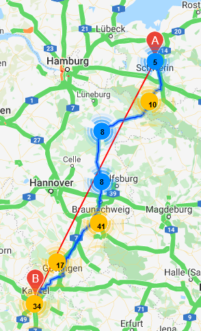
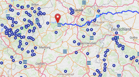
Zum Thema Tankstelle gehe ich wie folgt vor, bei der Routenerstellung nutze ich “Zeige Abbiegepunkte” und zeige “Tankstellen”. Als Beispiel https://kurv.gr/jcQ8P Start Hasselfelde, Deine Reichweite mit 190 km angenommen, klicke ich auf die Abbiegepunkte und sehe das Adelebsen bei ca. 190 km liegt und plane eine Tankstelle ein, zB die “Freie Tankstelle”. Vielleicht hilft das weiter?
For the topic petrol station I proceed as follows, for route creation I use “Show turn-off points” and show “petrol stations”. As an example https://kurv.gr/jcQ8P Start Hasselfelde, your range assumed to be 190 km, I click on the turn-off points and see that Adelebsen is at about 190 km and plan a petrol station, e.g. the “free petrol station”. Maybe this helps?
ich wusste es doch, dass ihr großes vorhabt. Die erste App steht kurz vor dem Aus. Den mit Offline-Routing brauche ich diese nicht mehr. Das ist ein gewaltiger Schritt zur EierlegendeWollmilchsau der Navigation. Ich merke es immer wieder, hier lohnt es sich mitzumachen
You can use the “x” on the right to reset the name and go back to the default name. When you import a route file, the name will be shown there as well and used for newly saved routes as well.

 .
.
 ):
):

 . Dies Wünsche wären von meiner Seite ein Schritt in diese Richtung