Yesterday and today a discoverded a fault in how Kurviger calculates a route. I wanted to upload a screenshot but because I am a new user it’s not allowed. I wil try to explain. Between 2 commandopoints on the A16 Netherlands (first hold to your right, followed bij hold to your left) verry near to each other Kurviger ads 76km and almost 1 hour of time. Yesterday when I was making a route through Belgium it did the same but at a roudabout in a complete other place then the A16. So you wil understand i’m losing my trust in Kurviger. I work with a Apple Notebook. Selected are fastest route and no avoidances. Does somebody knows what is wrong. Greetings Erwin
Schermafbeelding Kurviger.pdf (2.8 MB)
You can now upload screenshots to visualise your report ![]()
I stil got the message not allowed because I am new
I had to refresh. It is working now.
Hi Erwin,
Thanks for posting and welcome to the forum.
It would be good if you could share the link to the original route - I could reconstruct it like this from your screenshot:
What exactly do you see as a problem?
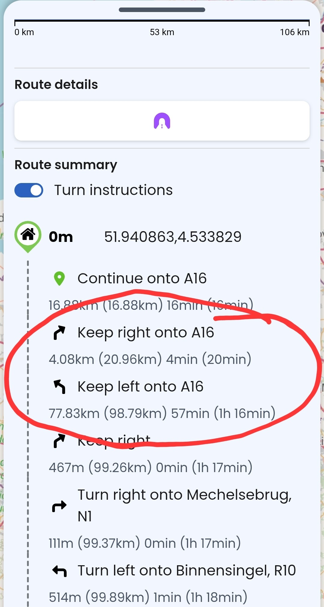
As indicated in turn instructions, those two poinrs are roughly 4km apart and the next point is 77.8km later - I do not see any time/distance unnecessarely added. Or maybe I misunderstood your message.
Thanks for the quick reply. You are absolutly wright. I made a mistake with that. I wil explain why I was looking for a fault. With other routeplanners the duration of the route is about 3:10 hours. With Kurviger 3:49. I planned the fastest route between Waddinxveen and Eden Ardenne, Chaussée de France, 25, 6840, Neufchâteau, Belgie. The routes are exactly the seem.
Time estimation is one of the topics that is often discussed here in forum. The bottom line is - yes, there is some room for improvement.
If the time is critical for your tour, it makes sense to cross check it with Google maps as they can provide more accurate information derived from user data collection..