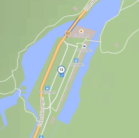
What is the problem between waypoints 12 and 13? Is it an error in OSM or the road is really blocked? It worked fine couple of months ago…
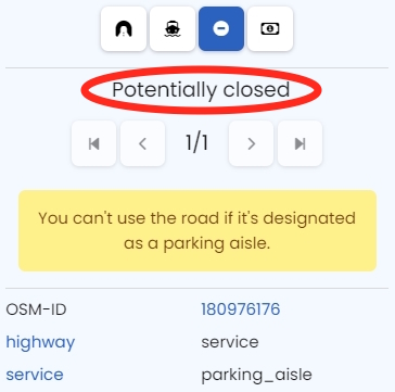
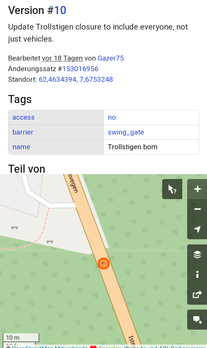
(12) is positioned on a parking aisle:
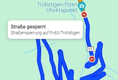
The bigger problem for you is that Trollstigen is closed for the rest of 2024 - see Die Bergstraße Trollstigen ist gesperrt …
1 Like
Ok, it is a pitty for Trollstiegen, but several weeks (or months) ago, when I planned the route initially there was no error with “parking aisle” reported. Of course, if I want to make a short break and walk around, I would navigate to a parking lot and would expect that Kurviger can continue the route from there (which it apparently does) - so why report an error? I had a similar situation when I wanted to make a stop near some shopping mall with a big parking lot. I could probably reproduce it if you want to have a look at it.
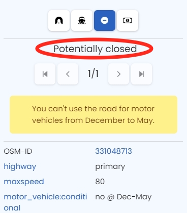
I also do not see the issue, as it seems to me it is properly tagged, still kurviger refuses from both sides (closed December to May for motor vehicles).
I cannot see this in OSM. So at least for nowit should not be relevant for planning in K3?
Not necessary - I know that …
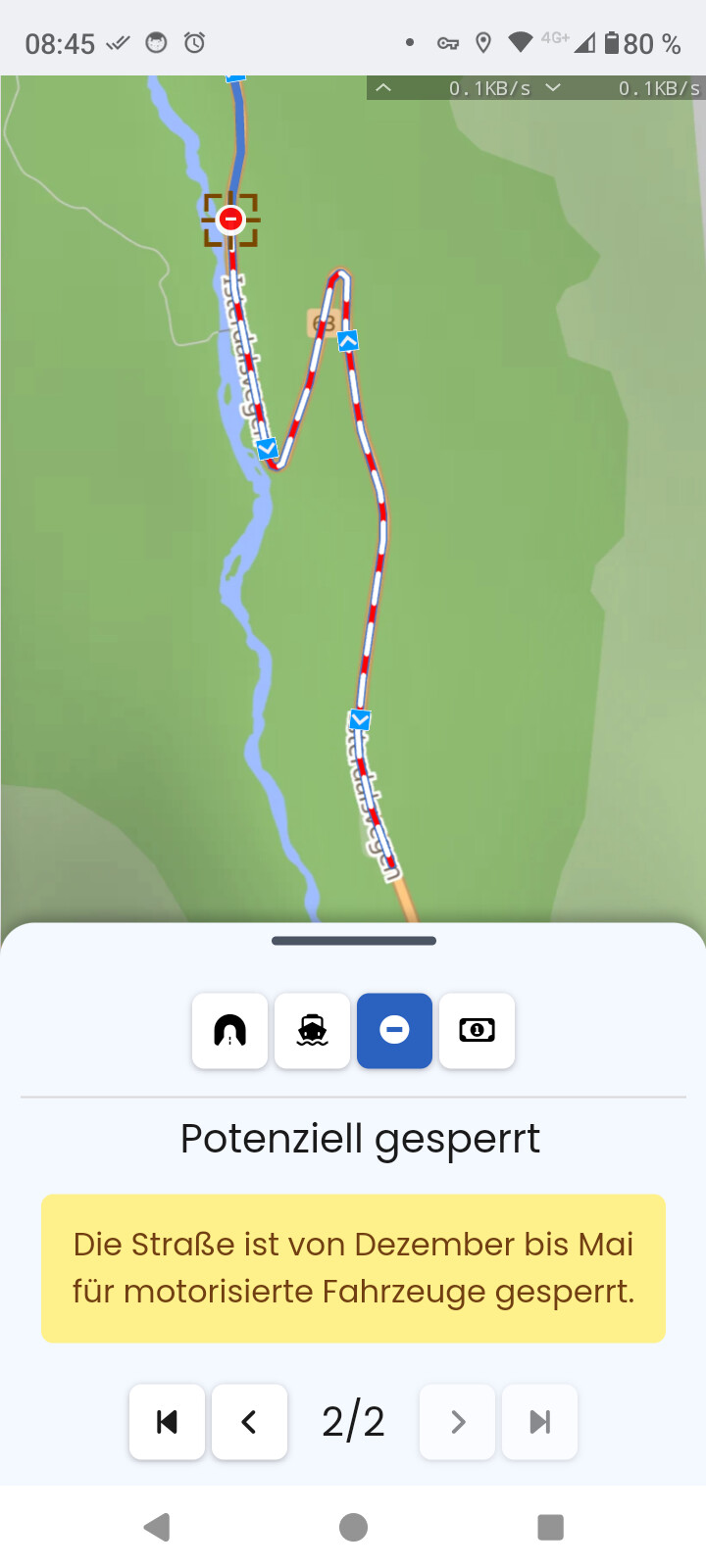
As you see, Kurviger does navigate you to the parking lot - but paint the route in red and warn you that it could be “potentially closed”:
If you set (12) to the road another potential closing is developing:
That’s a warning - nothing else.
Still strange for me.
It refuses in this case and does not allow to use the road (beside the fact that it is now closed already in Google). So from my point not just a warning. See the arrows of the route in my screenshot; it turns. I also placed the waypoint from the parking aisle on the road.
I just tested with a conditional closure in my area. There is a warning, but the road is used and I can decide.
“… völlig losgelöst …” sind hier zwei Themen von einander … aber find’s selbst raus …
1 Like
This is useful:
2 Likes