I have a very important question, is it possible to navigate with the web version?
Who knows … ![]()
BTW: There is an interesting project that wants to do exactly this. https://ffwdmejs.org/
Solution:
- Take your mobile comp.
- Charge battery.
- Take it with you.
- Create and open route in browser.
- You are old enough to be able to read a printed map?? THEN you are now able to read the map on the screen and follow it …

Problem
How to handle that on a bike if you are riding by yourself?? ![]()
![]()
According to this idea I have a little story (which sounds really funny today, but was somehow cool at that time).
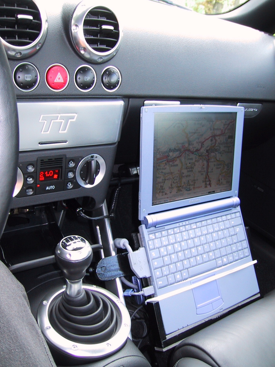
Back in the year 2000, I had an Audi TT with which I regularly drove to different car and fan events, driving and race trainings, and, of course, just anywhere to enjoy all those curves and landscapes. ![]()
At that time, GPS navigation was in it’s very early days. But it was possible to purchase a so called GPS-mouse, a ridiculous big device (in fact looking like a computer mouse) which could be attached to a laptop and therefore together with an appropriate software your were able to do satellite based navigation (almost exotic at that early period).
But I am and have always bin a “techie”, so it was clear for me that I have to build my own GPS-solution for my TT. So I crafted a mounting made from wood and metal, which clamped a Sony Vaio Notebook (which was quite small back then). On this notebook I used a software called “Fugawi 3 Moving Map” together with a GPS-mouse (I think it was a Holux GM-210).
Looked quite strange, but also futuristic and hey: it was a great equipment when participating in orientation tour driving events. ![]()
When reading this post, I remembered those days. And I even found an old picture, showing my construction. Would be also fine to use the Kurviger web version for navigation (well, OK, maybe not on a motorbike). ![]()