Hi, jus just noticed that im my village, there is a route calculated that is is not usable for several reasons:
there is no through traffic allowed (sign indicating this)
there are poles installed to prevent cars (and other vehicles) to pass through)
The location is in Saarbrücken Güdingen Neumühlerweg (behind old cemetery). Google maps shows the poles correctly and does not navigate through that street.
Can I upload some screen shots to ilustrate?
Thanks, B.
Yes. (with no promise to change it myself, as there is an even better way).
This is a quite common issue, and I guess everybody here knows such a place. I propose a better way. Kurviger uses the maps from OpenStreetMap, and everybody can contribute from beginner to pros - or as you - as an interested user, who just gives hints with some pictures, so the map can be improved. The advantage is, that the whole mapper community can see your hints. Very often, my hints are solved very quickly, some wait a little longer.
Please read here, the part for the app Streetcomplete is enough. It is done in a few minutes plus some more minutes to get familiar with the app.
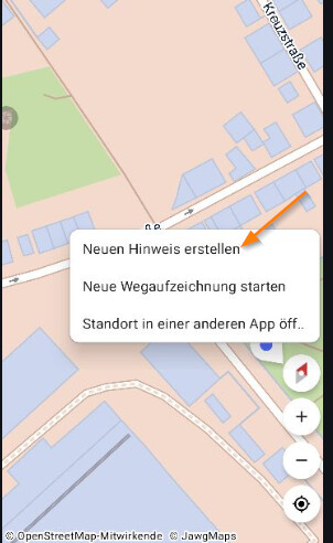
Additional to your case. When Streetcomplete is open, press your finger on the exact position and create a new hint.
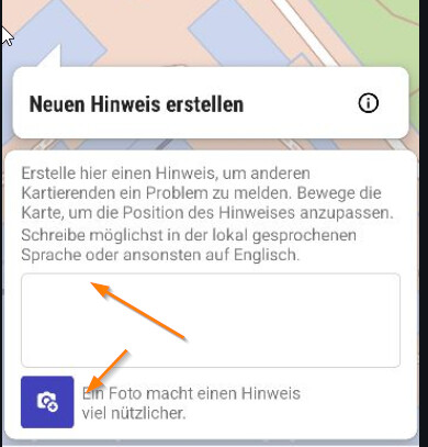
Write what you see (and is missing). You can take several pictures. Make pictures, where everybody can see, where is what in relation to the environment (a house, a crossing, ..).
Please avoid uploading pictures with people or even faces.
Upload. Done. If you find something different, same procedure.
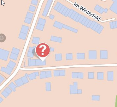
At the end, it will result like this hint in your area. In case you live there, you can click the symbol and add some information and perhaps pictures, and mappers can solve it.