During my last long trip I tested once again my own behaviour of digital navigation. And again I noticed, that I still combine Kurviger with (a) GMaps and (b) HERE.
Want to discuss both reasons here and in another topic.
In this topic: GMaps.
Reason:
When and why do I use GMaps?
I use it, when I want to reach a destination as soon as possible and take German Highways or Motorways, to be prepared to traffic jams (which are nearly unavoidable at the present) and to receive alternative routes, which works pretty well in Germany after many experiences.
On other two lane roads it is usually easy to turn back on the street, but not on roads with middle lanes, and it can cost you MUCH time to be “arrested” in a jam as you know.
So I nearly never start a highway route without GMaps.
Question:
Is there ANY chance to make it possible to implement any of comparable features to Kurviger?
Or is it just a completely different methodical approach?
Live traffic data is not available to us and most providers don’t sell this at all or for ridiculous amounts of money and usually with very strict license terms.
If we had live traffic data, it is extremely complicated to include this in a route planning system. Running live updates and still calculating routes fast enough is very hard.
This is low priority for a route planner that tries to avoid motorways and essentially most places where traffic jams happen.
Die TomTom Daten sind mit Abstand das Beste, was man derzeit bekommen kann. Auch die BMW Connected App nutzt die TT Verkehrsdaten.
Eine Integration in Kurviger wäre sehr zu begrüßen, denn dann müsste man nicht die Routen in TomTom Mydrive importieren, um nach Sperrungen usw. zu suchen.
Eine Darstellung in der App und Web könnte ich mir auch gegen eine Gebühr vorstellen.
Für denn Alltag nutze ich TomTom Go und für das Abfahren von geplanten Routen Kurviger.
While it might be technically possible to show TomTom data as an overlay, it definitly would cost money
I would not want to pay extra money for that in the Kurviger motorcycle app.
BTW:
TomTom forum seems to use the same forum-software as our forum
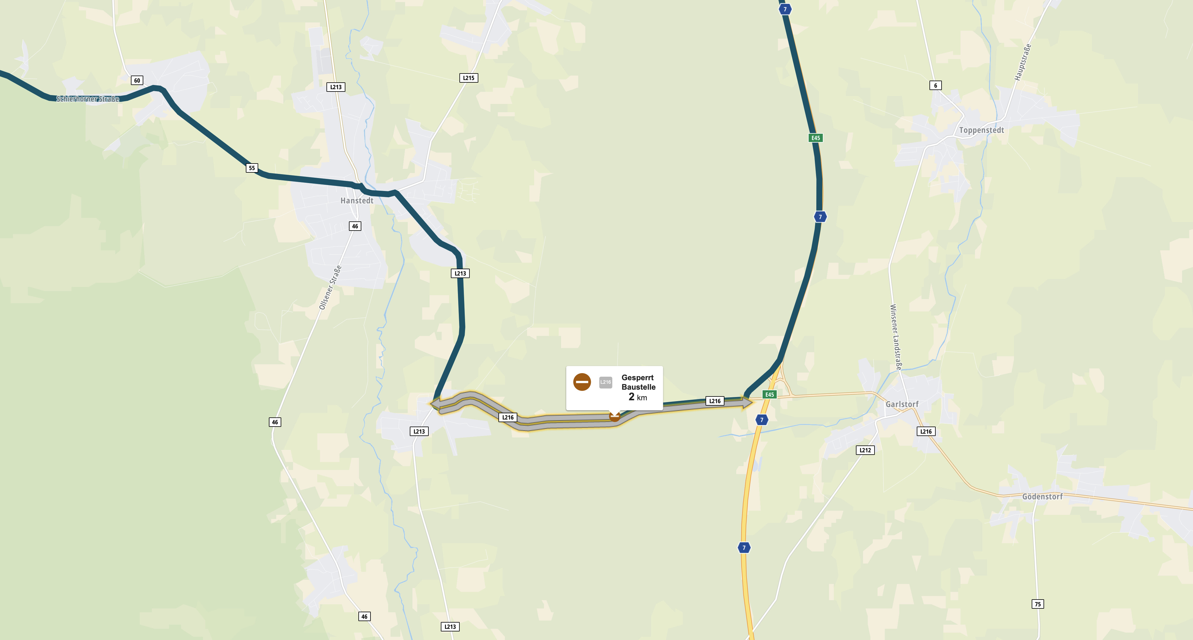
Die möglichkeit Verkahrsdaten in die Routenplanung einzubeziehen ist nicht zu unterschätzen. ich stand schon oft genung vor Sperrungen die ich nicht durchfahren konnte.
Ein Beispiel sieht man auf den Bilden:
Laut Kurviger und OSM ist die Abfahrt von der BAB 7 möglich
Das sind doch Live Daten. Live Daten sind nicht nur aktuelle Staus sondern auch Tagsesbaustellen und kurzfristige spontane Sperrungen (z.B. Radrennen). Live ist aus meiner Sicht alles das was nicht fest ist und sich im Status flexibel ändern kann.
A question for those who request live traffic data, purely out of interest. What does your driving profile look like, or do you need it mainly for (large) cities and/or motorways? Since I usually only drive on country roads and always deal well with the traffic, I don’t see any benefit for my driving profile. But of course it can look completely different with a different driving profile.
But it’s exactly the moment when I’m riding on a highway or in a city - there is much traffic and nothing tells me which roads I should use and which one I should avoid. So mostly I’m taking the wrong one and have to deal with it.
Yeah totally agree with you, most of the times it won’t be needed. But I can also 100% see the other side of this, it has happened so many times the google maps backup has saved my ass when I eventually had to cross Genova on the way to Cinque Terre or something like that. Road blocks and traffic can happen even on the most beautiful tours, at least here in europe. Maybe western US or Australia doesn’t have that problem