Die BMW App verbindet die Stützpunkte nicht mit Beelines, sondern führt eine “reguläre” Routenberechnung anhand der eingestellten Routenoptionen durch, und zeigt dann den berechneten Track an.
Wenn man gerne mit einem Track navigiert, kann das also durchaus Sinn machen.
Exactly, BC import, however not at all costs. I am one of the users that uses direct export to the XT without Basecamp (which is becoming obsolete anyway…. Thank you for all the hard work making XT exports possible!
I did some more research into this strange issue. https://zumouserforums.co.uk/viewtopic.php?t=3447
OMG! (Oh My Garmin) “look a little deeper into the zumo XT2 functionality, it makes more frustration than pleasure”
It is remarkable that Garmin, which has always been so strict in the past, does not respect its own GPX extension. I will have a further look in it. Not valid gpx seems to be very “un-Garmin”.
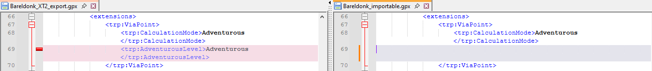
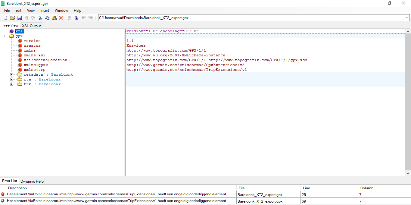
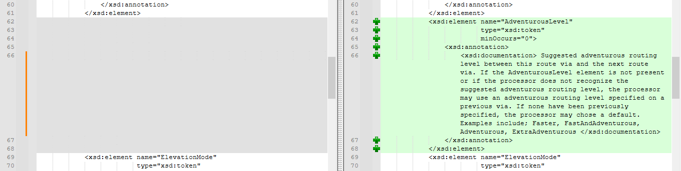
The GPX export refers to <trp:ViaPoint><trp:AdventurousLevel>, which is missing in the Garmin TripExtensionsV1.xsd.
Therefore, either the GPX export or the XSD is incorrect.
Technically this is correct. Basecamp does not understand TripExtensionsV2. Therefore we use V1, similarly to Garmins own software Garmin Explore which is the reference app for the Zumo XT2. If you compare the exports of Explore to our exports they are quite similar, Kurviger has more features though
We just work with what is available at Garmin and try to find the best compromise. If there is anything new at Garmin, please let us know and we are happy to revisit our export. I don’t have access to the XT2 anymore, so I can’t do any new tests anymore, but we did test a lot of different devices before we decided for the current schema.
@boldtrn
According to the attached file, Basecamp does recognize the shaping point. What is not recognized during import in Basecamp is that it concerns the Motorcycling mode. AnywayI can’t see more since I only have Openfietsmap installed. What is most important is how the XT2 sees all this, of course. Only someone with a device can judge this. Bareldonk_XT2_export_v2_valid.gpx (8.2 KB)
Correction. You are right. At the export it is than shown as a via point.