Kurviger 2.2.28 is on Google Play:
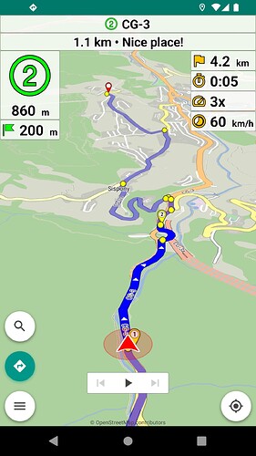
- Navigation: advanced route appearance (Pro)
Display the current route section differently from the rest of the route.
Available in “Settings | Navigation | Route appearance”.
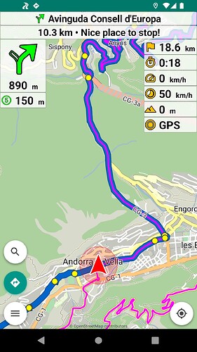
- Navigation: display next waypoint (Pro)
Display of the next waypoint is available as an optional extra panel.
Tapping the waypoint panel, the map moves briefly to the waypoint.
Available in “Settings | Navigation | Next waypoint”.
- Navigation: select next waypoint to display (Pro)
Selection of next waypoint to display is available with long press:
- Distance panel (top right)
- Next waypoint panel (top)
- Navigation: actions and options (Pro)
Available in top left navigation panel:
- Tap: show navigation actions
[Skip next waypoint, Avoid roadblock] - Long press: show navigation options
[Rerouting, Auto zoom, Voice guidance]
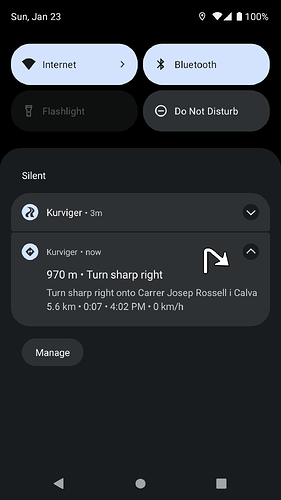
- Navigation: navigation notifications (Pro)
They can be useful with external screen devices.
Available in “Settings | Navigation | Notifications”.
- Navigation: icon color (Pro)
Separate icon color settings for navigation directions (left) and app panels (right).
Available in “Settings | Navigation | Icon color”.
- Navigation: simulation improvements (Pro)
Navigation simulation is initialized at the nearest route node.
Available in “Settings | Navigation | Navigation”.
- Navigation: Portuguese voice navigation (Pro)
Available in “Settings | Voice guidance | Voice language”.
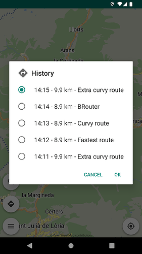
Offline in-memory history of latest calculated routes.
Useful for “undo” in route planning and navigation.
Available in menu “Routing | History”.
- Routing: scroll map to next / previous waypoint
You can scroll the map to the next or previous waypoint with new on-screen buttons.
(works together with the crosshair function)
Available in “Waypoints” in (long press) menu of the waypoints.
Available in “Waypoints” in (long press) menu of the route.
Available in (long press) menu of the waypoints.
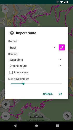
You can merge kurviger routes (files + links) using the “Extend route” option in routing import dialog.
Available in menu “Routing | Import”.
- Routing: different track colors
The import window has a color button to select the color of the imported track(s).
Available in import window of gpx / kurviger files.
- Routing: remember imported tracks
App remembers the imported (gpx, kurviger) tracks / colors when restarting the app.
- Routing: auto hide via / shaping points
You can select the zoom level where the via / shaping points appear on the map.
Available in “Settings | Routing | Via points (zoom level)”.
Available in “Settings | Routing | Shaping points (zoom level)”.
- Routing: auto hide turn instructions
You can select (or disable) the zoom level where the turn instructions appear on the map.
Available in “Settings | Routing | Zoom level of turn instructions”.
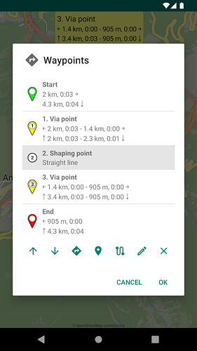
- Routing: distance / time in waypoints list
Display distance / time of waypoints in their management screen.
The same info is in the bubbles of waypoints when tapping them.
Available in menu “Routing | Waypoints”.
- Routing: distance / time icons in waypoints list
Display distance / time icons in the waypoints management screen.
The same info is in the bubbles of waypoints when tapping them.
Available in menu “Routing | Waypoints”.
- Routing: colored waypoints in waypoints list
Display colored waypoints in their management screen.
Available in menu “Routing | Waypoints”.
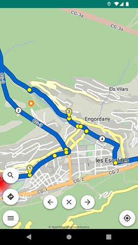
- Routing: route planning with coordinates
Enter a marker with coordinates on the map for routing actions.
Available in menu “Tools | Location”.
- Import: GPX overlay track + waypoints
You can overlay GPX track + waypoints via a new option.
Available in menu “Routing | Import”.
- Bookmarks: bookmark sort options
Sort function in bookmarks list offers options:
- Name
- Distance (from user)
More online maps are available.
Available in menu “Map | Online maps”.
Select quality or performance in map rendering.
Available in “Settings | Map | Rendering”.
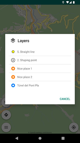
When you tap or long press in regions with multiple markers,
the available markers are displayed to select the one pressed.
Available in “Settings | Map | Layers”.
Available in “Settings | Map | Hide map scale”.
Location animation / interpolation for smooth movement in navigation / follow.
Available in “Settings | Location | Animated location”.
- Location: GPS altitude above sea level
GPS altitude can be read from:
- System (may be above sea level)
- Sensor (above sea level)
Available in “Settings | Location | Altitude”.
- Location: orientation threshold
Speed threshold for location orientation changes.
Available in “Settings | Location | Orientation threshold”.
- App: Daytona external input device
Daytona has its own profile in “Settings | Application | External input device”.
More external keys are available:
- N: navigation (start / pause / resume)
- F: follow location (on / off)
- S: skip next waypoint
- B: add bookmark
Available in “Settings | Application | External input device | Keyboard”.
- App: Android 13 compatibility
- Various improvements
Thanks to everyone who participated in Kurviger 2.2 (Beta) program!
We’re looking forward for your feedback about the new version and we wish you a nice Kurviger experience! ![]()
![]()
